|
search place name
|
||
Tokchanggae (Hamgyŏng, Korea, North)Tokchanggae is a town in the Hamgyŏng region of Korea, North. An overview map of the region around Tokchanggae is displayed below.
regional and 3d topo map of Tokchanggae, Korea, North ::
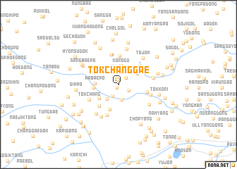
Nearby towns ::
Tokchangp'o (0.5km south west) //
Sanch'i-gol (0.7km north) //
Malgadŏk (1.4km north east) //
Subuk (1.5km south east) //
Sang-ch'on (1.9km south) //
Ha-ch'on (2.4km south) //
Hariman (2.7km south west) //
Korŏgu (3.0km north) //
Songnim-ni (3.0km north west) //
Pak-tong (2.9km north east) //
Habaep'o (2.8km west) //
Iman (3.2km south west) //
Pakchŏnjang (3.2km north east) //
Harip'o (3.1km west) //
Man'gŭmp'o (4.1km south) //
Anjŏnjang (3.8km north east) //
Salbau (4.6km north) //
Sadŭk (4.2km south west) //
Hwadae (3.6km east) //
Hongsu-gol (4.8km north) //
Hongsu-gol (4.8km north) //
Tokchang (4.2km south west) //
Such'im (5.1km south) //
Hwaryong-ni (4.1km south east) //
Tojŏm (5.1km north east) //
Ohyang-ch'on (4.3km east) //
Anch'ungdŏgi (4.8km south east) //
Paktumugae (5.7km north) //
Sandae (5.5km south) //
[all distances 'as the bird flies' and approximate] 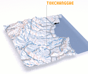 Places with similar names to Tokchanggae, Korea, North ::
// Tkachenko (RU)
// Tkachenko (RU)
// Tauksha-aing (MM)
// Tkachenka (UA)
// Dikushenki (RU)
// Dakshin Ghāgua (BD)
// Tokchang (KP)
// Tokchang (KP)
// Tokchang (KP)
// Tokchang (KP)
Disclaimer :: Information on this page comes without warranty of any kind |
||
|
Where is Tokchanggae? Elevation and coordinates ::
Latitude (lat): 41°20'17"N Longitude (lon): 129°26'10"E
Elevation (approx.): 434m (map arrows pan, magnifying glasses zoom) |
||
|
Visiting Tokchanggae? Hotel/Accommodation ::
Book a hotel in Tokchanggae Travel Guide ::
rental cars ::
car rental offers GPS waypoint ::
download a GPX waypoint (PoI) of Tokchanggae for your GPS receiver
|
||