|
search place name
|
||
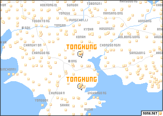
Tonghŭng (Korea, North)Tonghŭng is a town in Korea, North. An overview map of the region around Tonghŭng is displayed below.
regional and 3d topo map of Tonghŭng, Korea, North ::
Tonghŭng airports ::
The nearest airport is FNJ - Pyongyang Intl, located 101.8 km south east of Tonghŭng.
Nearby towns ::
Tongch'ŏl-li (1.2km north) //
Tongyang (1.9km north) //
Sambong (1.9km south) //
Kŭmbong (1.9km south) //
Su-dong (1.8km north west) //
Subu-ri (2.2km south east) //
Wŏlbong-ni (2.2km south west) //
Yongbong (2.3km north east) //
Sambong (2.3km north east) //
Tŏkbawi (2.3km south east) //
Unam-ni (2.3km north west) //
Sinp'ung (2.3km south west) //
Songam (2.3km south west) //
Ibong (2.3km south west) //
Tobong (2.3km south west) //
Hakchŏng (2.3km south west) //
Tongp'yŏng-ni (2.8km north east) //
Kŏnam (3.7km north) //
Yŏngbong (2.8km west) //
Naeam-dong (3.6km south east) //
Chigyŏng (4.0km north) //
Kŭnp'yŏng (4.0km north) //
Pubong (3.4km north west) //
Taegye-ri (4.0km south) //
Tongji-ri (3.9km north east) //
Ssangam-dong (4.5km south) //
Myŏngam-ni (4.5km south) //
Taebong (4.1km south west) //
Yŏngsang-ni (4.5km south west) //
[all distances 'as the bird flies' and approximate] 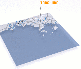 Places with similar names to Tonghŭng, Korea, North ::
// Taung Hin-ngu (MM)
// Taunghnauk (MM)
// Danevang (US)
// Tinfangué (BF)
// Tonghŭng (KP)
// Tonghŭng (KP)
// Tanghang (KR)
// Dounfing (ML)
// T'onghang (KP)
// Tan-feng (TW)
Disclaimer :: Information on this page comes without warranty of any kind |
||
|
Where is Tonghŭng? Elevation and coordinates ::
Latitude (lat): 39°46'0"N Longitude (lon): 124°43'0"E
Elevation (approx.): 4m (map arrows pan, magnifying glasses zoom) |
||
|
Visiting Tonghŭng? Hotel/Accommodation ::
Book a hotel in Tonghŭng Travel Guide ::
rental cars ::
car rental offers GPS waypoint ::
download a GPX waypoint (PoI) of Tonghŭng for your GPS receiver
|
||