|
search place name
|
||
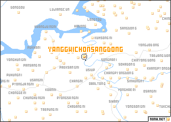
Yanggwich'ŏnsang-dong (Korea, North)Yanggwich'ŏnsang-dong is a town in Korea, North. An overview map of the region around Yanggwich'ŏnsang-dong is displayed below.
regional and 3d topo map of Yanggwich'ŏnsang-dong, Korea, North ::
Yanggwich'ŏnsang-dong airports ::
The nearest airport is FNJ - Pyongyang Intl, located 163.9 km south of Yanggwich'ŏnsang-dong.
Nearby towns ::
Naesŏng-ni (1.4km north west) //
Songjŏng-ni (1.9km north) //
Yanggwich'ŏnha-dong (2.3km north east) //
Oha-ri (2.3km north east) //
Tonggu-ri (2.3km north east) //
Usi-ŭp (3.2km south) //
Kaesŏng-ni (2.9km north west) //
Kŭmch'ang-dong (3.6km north) //
Sŏgu-ri (3.7km south) //
Kŭmyang-ni (3.0km north east) //
Sinni-dong (3.4km north east) //
Kuryong-ni (4.0km south) //
Yonghŭng-ni (3.4km north west) //
Paeksang-ni (3.6km south west) //
Ch'ang-ni (3.6km west) //
Hagalp'a (3.8km south east) //
Sanggalp'a (4.7km south east) //
Chunggalp'a (4.7km south east) //
Sŏngsŏ-dong (5.2km north) //
Songp'a-ri (4.1km east) //
Hwap'yŏng-ni (4.2km west) //
Kŭmsŏng-ni (5.1km north east) //
Ch'ang-ni (5.7km south) //
Osang-ni (4.8km west) //
Naeyŏn-dong (6.5km north) //
Ha-dong (6.5km north) //
Ŏbal-tong (6.4km south) //
Kŏlsangha-dong (5.6km north east) //
Naep'yŏng-dong (5.6km south east) //
[all distances 'as the bird flies' and approximate] 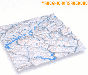 Places with similar names to Yanggwich'ŏnsang-dong, Korea, North :: Disclaimer :: Information on this page comes without warranty of any kind |
||
|
Where is Yanggwich'ŏnsang-dong? Elevation and coordinates ::
Latitude (lat): 40°42'0"N Longitude (lon): 125°39'0"E
Elevation (approx.): 166m (map arrows pan, magnifying glasses zoom) |
||
|
Visiting Yanggwich'ŏnsang-dong? Hotel/Accommodation ::
Book a hotel in Yanggwich'ŏnsang-dong Travel Guide ::
rental cars ::
car rental offers GPS waypoint ::
download a GPX waypoint (PoI) of Yanggwich'ŏnsang-dong for your GPS receiver
|
||