|
search place name
|
||
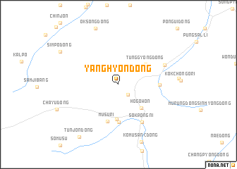
Yanghyŏn-dong (Hamgyŏng, Korea, North)Yanghyŏn-dong is a town in the Hamgyŏng region of Korea, North. An overview map of the region around Yanghyŏn-dong is displayed below.
regional and 3d topo map of Yanghyŏn-dong, Korea, North ::
Nearby towns ::
Ch'angp'yŏng-ni (2.0km south east) //
Hŏgowŏn (4.6km south east) //
Tŭnggyŏng-dong (4.5km north east) //
Nŭrŭmp'yŏng (5.5km south) //
Mokchok-tong (6.0km south) //
Musu-ri (6.0km south) //
Chŏn'gŏ-ri (4.8km east) //
Sŏkpong-ni (6.6km south east) //
Susang-dong (6.2km north east) //
Oksŏng-dong (9.3km north) //
Tunjŏn-dong (9.5km south west) //
[all distances 'as the bird flies' and approximate] 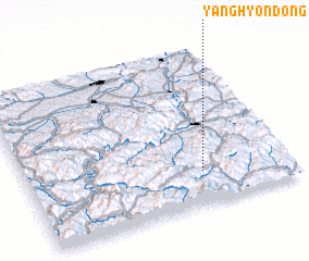 Places with similar names to Yanghyŏn-dong, Korea, North ::
// Yonghyŏn-dong (KP)
Disclaimer :: Information on this page comes without warranty of any kind |
||
|
Where is Yanghyŏn-dong? Elevation and coordinates ::
Latitude (lat): 42°12'13"N Longitude (lon): 129°39'59"E
Elevation (approx.): 423m (map arrows pan, magnifying glasses zoom) |
||
|
Visiting Yanghyŏn-dong? Hotel/Accommodation ::
Book a hotel in Yanghyŏn-dong Travel Guide ::
rental cars ::
car rental offers GPS waypoint ::
download a GPX waypoint (PoI) of Yanghyŏn-dong for your GPS receiver
|
||