|
search place name
|
||
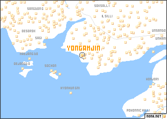
Yongamjin (P'yŏngan, Korea, North)Yongamjin is a town in the P'yŏngan region of Korea, North. An overview map of the region around Yongamjin is displayed below.
regional and 3d topo map of Yongamjin, Korea, North ::
Yongamjin airports ::
The nearest airport is FNJ - Pyongyang Intl, located 50.7 km south east of Yongamjin.
Other airports nearby include GMP - Seoul Gimpo (258.4 km south east), Nearby towns ::
Maam-ch'on (0.5km north east) //
Kobangsan (1.2km north) //
Paesan (1.4km east) //
Yangji (1.7km north east) //
Tangje (2.2km north) //
Muksan (1.9km north east) //
Ch'ilchŏn-dong (2.4km north) //
Sema-ri (2.5km north) //
K'ŭnmal (2.7km north) //
Tanghu (2.8km north west) //
Chŏngyang-dong (2.9km north east) //
Kŏmsan (2.8km east) //
Yonghyŏn-dong (2.8km east) //
T'ongsa (3.7km north) //
Munsan (2.9km east) //
Kuam-dong (3.1km south east) //
Pŏnjwa-ri (3.5km north west) //
Hŭgamch'on (3.0km east) //
Tongyangch'on (3.3km east) //
Chasŏng-dong (3.8km north east) //
Sangso-ri (4.3km north) //
Tangjŏn (3.7km north east) //
Ch'ŏngnyongch'on (4.1km north east) //
Irhae-ri (3.9km east) //
An'gwangch'on (4.3km north east) //
O-ri (5.1km north) //
Kwanch'ang (5.2km north east) //
Sinbong-ni (5.5km north) //
Chŏngnok (4.4km east) //
[all distances 'as the bird flies' and approximate] 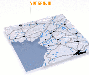 Places with similar names to Yongamjin, Korea, North ::
// Yangmijian (CN)
Disclaimer :: Information on this page comes without warranty of any kind |
||
|
Where is Yongamjin? Elevation and coordinates ::
Latitude (lat): 39°33'4"N Longitude (lon): 125°15'32"E
Elevation (approx.): 17m (map arrows pan, magnifying glasses zoom) |
||
|
Visiting Yongamjin? Hotel/Accommodation ::
Book a hotel in Yongamjin Travel Guide ::
rental cars ::
car rental offers GPS waypoint ::
download a GPX waypoint (PoI) of Yongamjin for your GPS receiver
|
||