|
search place name
|
||
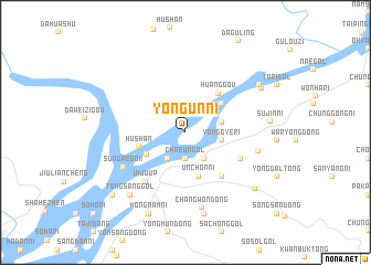
Yongun-ni (P'yŏngan, Korea, North)Yongun-ni is a town in the P'yŏngan region of Korea, North. An overview map of the region around Yongun-ni is displayed below.
regional and 3d topo map of Yongun-ni, Korea, North ::
Yongun-ni airports ::
The nearest airport is FNJ - Pyongyang Intl, located 147.3 km south east of Yongun-ni.
Nearby towns ::
Kuangdonggou (2.5km north) //
Ch'aeun'gol (2.7km south) //
Wŏnhwa-dong (3.0km south west) //
Tongsanggok (3.0km south west) //
Yongmun-dong (3.0km south east) //
Yonggye-ri (3.0km east) //
Sŏkkye-dong (3.0km east) //
Ŏjŏk-tong (3.7km south west) //
Unch'ŏn-ni (4.6km south) //
Puksanggok (4.1km north east) //
Hushan (3.9km west) //
Huanggou (4.7km north east) //
Tonggok (5.3km south east) //
Misong-ni (5.0km south east) //
Ŭiju-ŭp (5.9km south west) //
Sŭngaegok (6.0km south west) //
Misan-dong (5.9km east) //
Ch'angwŏn-dong (7.7km south) //
Yŏnmu-ri (8.3km south) //
Tongsanggol (7.6km south west) //
Sujin-ni (6.7km east) //
Taehwa-ri (7.4km north east) //
Sugudo (7.4km north east) //
Sŏnggok (7.4km north east) //
Hongnam-ni (8.7km south) //
Kŭmgwang-ni (7.8km south east) //
Tongsamgol (8.5km south west) //
[all distances 'as the bird flies' and approximate] 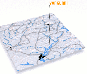 Places with similar names to Yongun-ni, Korea, North ::
// Yanacani (BO)
// Yankan (RU)
// Yankan (RU)
// Yan'kina (RU)
// Yankino (RU)
// Yenigün (AZ)
// Yenkino (RU)
// Yiannakianá (GR)
// Yianníkion (GR)
// Yenigün (TR)
Disclaimer :: Information on this page comes without warranty of any kind |
||
|
Where is Yongun-ni? Elevation and coordinates ::
Latitude (lat): 40°14'26"N Longitude (lon): 124°33'59"E
Elevation (approx.): 17m (map arrows pan, magnifying glasses zoom) |
||
|
Visiting Yongun-ni? Hotel/Accommodation ::
Book a hotel in Yongun-ni Travel Guide ::
rental cars ::
car rental offers GPS waypoint ::
download a GPX waypoint (PoI) of Yongun-ni for your GPS receiver
|
||