|
search place name
|
||
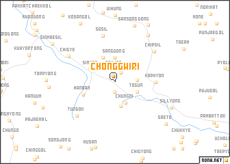
Chŏnggwi-ri (Kyŏngsang, Korea, South)Chŏnggwi-ri is a town in the Kyŏngsang region of Korea, South. An overview map of the region around Chŏnggwi-ri is displayed below.
regional and 3d topo map of Chŏnggwi-ri, Korea, South ::
Chŏnggwi-ri airports ::
The nearest airport is TAE - Taegu Daegu Ab, located 21.1 km south of Chŏnggwi-ri.
Other airports nearby include KPO - Pohang (65.7 km east), YEC - Yechon Yecheon (68.6 km north west), USN - Ulsan (79.9 km south east), PUS - Kimhae Gimhae Intl (102.3 km south), Nearby towns ::
Chŏn'gwi-ri (1.6km south) //
Pŏmha-dong (1.6km north east) //
Sŏmjae (2.1km north) //
Hwajŏng-dong (2.9km east) //
Chung-ni (3.7km south) //
Togŭn (3.3km south east) //
Sang-dong (4.0km north) //
Sinsiam (4.0km south) //
Sinwŏn (3.7km north west) //
Ha-dong (4.3km north) //
Kubang-dong (3.9km north west) //
Hanbam (4.7km south west) //
Kaphyŏn (5.3km east) //
Sosil (7.7km north) //
Chipsil (7.1km north east) //
Tundŏk (7.5km south west) //
Chigye (7.4km north west) //
Kyemyŏng-dong (8.8km north east) //
Saet'ŏ (9.6km south east) //
[all distances 'as the bird flies' and approximate] 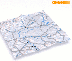 Places with similar names to Chŏnggwi-ri, Korea, South ::
// Shīna Khwara (PK)
// Chungwi-ri (KP)
// Chŏn'gwi-ri (KR)
// Shīna Khwārah (PK)
// Chinkwiri (MW)
// Chinkwiri (MW)
Disclaimer :: Information on this page comes without warranty of any kind |
||
|
Where is Chŏnggwi-ri? Elevation and coordinates ::
Latitude (lat): 36°4'52"N Longitude (lon): 128°42'3"E
Elevation (approx.): 206m (map arrows pan, magnifying glasses zoom) |
||
|
Visiting Chŏnggwi-ri? Hotel/Accommodation ::
Book a hotel in Chŏnggwi-ri Travel Guide ::
rental cars ::
car rental offers GPS waypoint ::
download a GPX waypoint (PoI) of Chŏnggwi-ri for your GPS receiver
|
||