|
search place name
|
||
Chŏngjang-ni (Ch'ungch'ŏng, Korea, South)Chŏngjang-ni is a town in the Ch'ungch'ŏng region of Korea, South. An overview map of the region around Chŏngjang-ni is displayed below.
regional and 3d topo map of Chŏngjang-ni, Korea, South ::

Chŏngjang-ni airports ::
The nearest airport is KUB - Kunsan Ab, located 80.6 km west of Chŏngjang-ni.
Other airports nearby include YEC - Yechon Yecheon (96.2 km north east), OSN - Osan Ab (109.2 km north), TAE - Taegu Daegu Ab (113.1 km east), KWJ - Kwangju Gwangju (129.2 km south west), Nearby towns ::
Yongjil-li (2.1km north west) //
Tabok-kol (2.4km south west) //
Majŏl-li (2.9km north east) //
Tabong-ni (2.7km west) //
P'ach'o-ri (3.7km south) //
Hasil-li (3.3km east) //
Kamokchŏng (4.0km north) //
Haso-dong (4.9km north) //
Hwarim-ni (5.0km south west) //
Suyŏng-gol (4.5km west) //
Susimdae (4.5km west) //
Kongnam-ni (4.9km west) //
Puam-ni (5.4km south west) //
Yangjibat'tŭl (6.3km south east) //
Kŏmhan-ni (6.3km north east) //
Ŭmjibat'tŭl (6.3km south east) //
Sangŏmjŏng (6.3km south west) //
Sangso-dong (7.0km north) //
Yangji-ri (7.6km south) //
Chojŏng (6.3km east) //
Maengch'i (7.1km north west) //
Kurye-ri (6.6km north west) //
Torimoe (8.0km north) //
K'ŭnmal (7.0km north east) //
Sang-ni (7.0km north west) //
Kŭmsan (7.9km south east) //
Tudu-ri (6.9km east) //
Tongp'yŏl-li (7.1km east) //
Sŏt'ae-ri (7.7km north east) //
[all distances 'as the bird flies' and approximate] 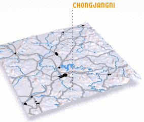 Places with similar names to Chŏngjang-ni, Korea, South ::
// Changjŏng-ni (KP)
// Changjŏng-ni (KP)
// Ch'ŏngjŏng-ni (KP)
// Ch'ŏngjŏng-ni (KP)
// Chungjangnae (KP)
// Chungjangnae (KP)
// Chungjang-ni (KP)
// Ch'angjŏng-ni (KR)
// Ch'angjŏng-ni (KR)
// Changjŏng-ni (KR)
Disclaimer :: Information on this page comes without warranty of any kind |
||
|
Where is Chŏngjang-ni? Elevation and coordinates ::
Latitude (lat): 36°10'0"N Longitude (lon): 127°27'0"E
Elevation (approx.): 249m (map arrows pan, magnifying glasses zoom) |
||
|
Visiting Chŏngjang-ni? Hotel/Accommodation ::
Book a hotel in Chŏngjang-ni Travel Guide ::
rental cars ::
car rental offers GPS waypoint ::
download a GPX waypoint (PoI) of Chŏngjang-ni for your GPS receiver
|
||