|
search place name
|
||
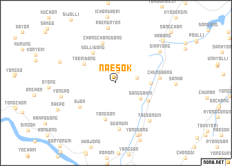
Naesŏk (Kyŏngsang, Korea, South)Naesŏk is a town in the Kyŏngsang region of Korea, South. An overview map of the region around Naesŏk is displayed below.
regional and 3d topo map of Naesŏk, Korea, South ::
Naesŏk airports ::
The nearest airport is PUS - Kimhae Gimhae Intl, located 30.1 km south of Naesŏk.
Other airports nearby include USN - Ulsan (34.5 km north east), TAE - Taegu Daegu Ab (59.8 km north west), KPO - Pohang (70.5 km north east), TSJ - Tsushima (131.5 km south), Nearby towns ::
Oryong-gol (1.9km north) //
Karimi (2.9km east) //
Sangsam-ni (4.1km south east) //
Yongyŏl-li (4.6km east) //
Samge (5.1km south east) //
Taeri-dong (5.2km north west) //
Sŏlli-dong (5.7km north west) //
Yongsŏn (6.0km south) //
Changch'ŏng-dong (6.6km north) //
Ŏjŏn (6.2km south west) //
Chungbang (5.8km east) //
Ŏgong-ni (7.4km south) //
Taesŏng-ni (7.5km south east) //
Sinp'yŏng (7.7km north east) //
Yŏng-dong (8.9km south) //
Yŏngp'o (7.6km west) //
Pukchŏng-ni (8.9km south) //
Habang (9.1km north east) //
Panggi-ri (9.2km north east) //
[all distances 'as the bird flies' and approximate] 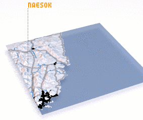 Places with similar names to Naesŏk, Korea, South ::
Disclaimer :: Information on this page comes without warranty of any kind |
||
|
Where is Naesŏk? Elevation and coordinates ::
Latitude (lat): 35°26'33"N Longitude (lon): 129°1'11"E
Elevation (approx.): 260m (map arrows pan, magnifying glasses zoom) |
||
|
Visiting Naesŏk? Hotel/Accommodation ::
Book a hotel in Naesŏk Travel Guide ::
rental cars ::
car rental offers GPS waypoint ::
download a GPX waypoint (PoI) of Naesŏk for your GPS receiver
|
||