|
search place name
|
||
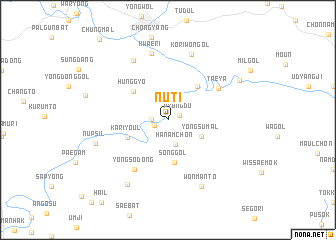
Nŭt'i (Ch'ungch'ŏng, Korea, South)Nŭt'i is a town in the Ch'ungch'ŏng region of Korea, South. An overview map of the region around Nŭt'i is displayed below.
regional and 3d topo map of Nŭt'i, Korea, South ::
Nŭt'i airports ::
The nearest airport is YEC - Yechon Yecheon, located 51.7 km south of Nŭt'i.
Other airports nearby include KAG - Kangnung Gangneung (84.1 km north east), SHO - Sokch'o Sokcho (117.9 km north), SSN - Seoul East Seoul Ab (129.4 km west), OSN - Osan Ab (130.7 km west), Nearby towns ::
Pyŏngdu (1.2km north east) //
Sang-ni (1.3km south west) //
Yŏngch'un (1.5km west) //
Hanamch'ŏn (2.9km south) //
Yongsumal (3.5km south east) //
Sŏng-gol (4.8km south) //
Hŭnggyo (4.4km north west) //
Kariyŏul (4.1km south west) //
Chung-mal (4.6km north east) //
Taeya (5.7km north east) //
Yongso-dong (6.3km south west) //
Kwae-ri (7.6km north) //
Talchi-mal (7.3km north west) //
Kŏriwŏn-gol (7.6km north) //
Wŏnmant'ŏ (8.0km south) //
Nŭpsil (6.9km west) //
Komjŏl (8.1km south west) //
Oktong-ni (7.7km north east) //
[all distances 'as the bird flies' and approximate] 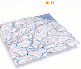 Places with similar names to Nŭt'i, Korea, South ::
Disclaimer :: Information on this page comes without warranty of any kind |
||
|
Where is Nŭt'i? Elevation and coordinates ::
Latitude (lat): 37°5'0"N Longitude (lon): 128°30'0"E
Elevation (approx.): 196m (map arrows pan, magnifying glasses zoom) |
||
|
Visiting Nŭt'i? Hotel/Accommodation ::
Book a hotel in Nŭt'i Travel Guide ::
rental cars ::
car rental offers GPS waypoint ::
download a GPX waypoint (PoI) of Nŭt'i for your GPS receiver
|
||