|
search place name
|
||
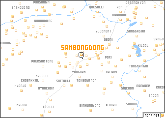
Sambong-dong (Kangwŏn, Korea, South)Sambong-dong is a town in the Kangwŏn region of Korea, South. An overview map of the region around Sambong-dong is displayed below.
regional and 3d topo map of Sambong-dong, Korea, South ::
Sambong-dong airports ::
The nearest airport is GMP - Seoul Gimpo, located 85.9 km south west of Sambong-dong.
Other airports nearby include SSN - Seoul East Seoul Ab (91.7 km south), SHO - Sokch'o Sokcho (125.7 km east), OSN - Osan Ab (131.5 km south), KAG - Kangnung Gangneung (165.8 km east), Nearby towns ::
Yonggang (1.0km north east) //
Kwanp'o (1.1km south west) //
Umi-dong (1.3km north west) //
Hamasan (1.6km north) //
Sabangji-ri (1.3km east) //
Chuŭlp'o (1.5km south east) //
Mosiul (1.5km south west) //
Sinp'o-dong (1.7km south) //
Moho-dong (2.5km south west) //
Pongyang-dong (2.4km south west) //
Oesŏl-li (2.8km north east) //
Kan-ch'on (2.8km east) //
Chojŏl-li (2.9km east) //
Honggye-dong (3.0km west) //
Sahu-dong (3.3km north west) //
Yongdam (4.1km south) //
Pongam-dong (3.5km south west) //
Chungnaesŏn (3.6km north east) //
P'o-ch'on (3.6km east) //
Ch'ŏnt'ong-ni (4.2km north east) //
Wŏrha-ri (4.4km south east) //
Hawasŏl-li (4.5km north east) //
Chungt'o-dong (4.3km west) //
Sangt'o-dong (4.4km west) //
Chaesong-ni (4.9km north east) //
P'o-ri (4.7km east) //
Toksŏdang-ni (6.0km south) //
Kalma-dong (5.4km south west) //
Pugŏ-ri (6.3km south) //
[all distances 'as the bird flies' and approximate] 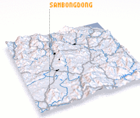 Places with similar names to Sambong-dong, Korea, South ::
// Sambong-dong (KP)
// Sambong-dong (KP)
// Sambong-dong (KP)
// Sambong-dong (KP)
// Sambong-dong (KP)
// Simbong-dong (KP)
// Sambang-dong (KR)
// Sambong-dong (KP)
// Sambong-dong (KP)
// Xóm Bang Dung (VN)
Disclaimer :: Information on this page comes without warranty of any kind |
||
|
Where is Sambong-dong? Elevation and coordinates ::
Latitude (lat): 38°16'13"N Longitude (lon): 127°10'21"E
Elevation (approx.): 194m (map arrows pan, magnifying glasses zoom) |
||
|
Visiting Sambong-dong? Hotel/Accommodation ::
Book a hotel in Sambong-dong Travel Guide ::
rental cars ::
car rental offers GPS waypoint ::
download a GPX waypoint (PoI) of Sambong-dong for your GPS receiver
|
||