|
search place name
|
||
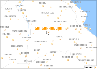
Sanghwangjimi (Kangwŏn, Korea, South)Sanghwangjimi is a town in the Kangwŏn region of Korea, South. An overview map of the region around Sanghwangjimi is displayed below.
regional and 3d topo map of Sanghwangjimi, Korea, South ::
Sanghwangjimi airports ::
The nearest airport is KAG - Kangnung Gangneung, located 17.5 km north of Sanghwangjimi.
Other airports nearby include SHO - Sokch'o Sokcho (66.9 km north west), YEC - Yechon Yecheon (118.4 km south west), SSN - Seoul East Seoul Ab (160.7 km west), OSN - Osan Ab (176.8 km west), Nearby towns ::
Chŏl-gol (2.7km south east) //
Yŏngmit (3.8km south) //
Koyambat (3.4km north east) //
Wŏndŭl (4.0km south east) //
Kŭmbang-dong (4.5km south west) //
Changgibawi (4.9km west) //
Wŏlchŏn-dong (5.4km north east) //
Araehŭnae (5.9km east) //
Tan'gyŏng-gol (7.3km north) //
K'ŭn-gol (7.0km north east) //
P'yŏng-ch'on (6.6km north west) //
Sagimak (6.4km north east) //
Kundae (8.2km south) //
Konae (7.9km south west) //
Kuryong-dong (8.3km south) //
Yŏngmaru (7.0km west) //
Chŏl-gol (8.5km north east) //
T'ap-tong (9.9km north west) //
Oegodan (10.8km south west) //
[all distances 'as the bird flies' and approximate] 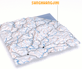 Places with similar names to Sanghwangjimi, Korea, South :: Disclaimer :: Information on this page comes without warranty of any kind |
||
|
Where is Sanghwangjimi? Elevation and coordinates ::
Latitude (lat): 37°35'49"N Longitude (lon): 128°55'18"E
Elevation (approx.): 262m (map arrows pan, magnifying glasses zoom) |
||
|
Visiting Sanghwangjimi? Hotel/Accommodation ::
Book a hotel in Sanghwangjimi Travel Guide ::
rental cars ::
car rental offers GPS waypoint ::
download a GPX waypoint (PoI) of Sanghwangjimi for your GPS receiver
|
||