|
search place name
|
||
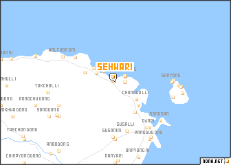
Sehwa-ri (Cheju, Korea, South)Sehwa-ri is a town in the Cheju region of Korea, South. An overview map of the region around Sehwa-ri is displayed below.
regional and 3d topo map of Sehwa-ri, Korea, South ::
Sehwa-ri airports ::
The nearest airport is CJU - Cheju Jeju Intl, located 34.7 km west of Sehwa-ri.
Other airports nearby include RSU - Yeosu (162.5 km north east), KWJ - Kwangju Gwangju (178.6 km north), FUJ - Fukue (206.4 km south east), Nearby towns ::
Kujwa (0.5km west) //
Hado-ri (1.2km east) //
Sŏmun-dong (1.6km north east) //
Sin-dong (1.6km north east) //
Taesuha-dong (2.4km north west) //
P'yŏngdae-ri (3.0km north west) //
Kyeryong-dong (3.7km north west) //
Chongdal-li (3.9km south east) //
Chung-dong (4.8km south east) //
Handong-ni (4.5km west) //
Sihŭng-ni (5.6km south east) //
Haengwŏl-li (6.8km north west) //
Susal-li (8.0km south) //
Kosŏng-ni (8.5km south east) //
Ojo-ri (8.7km south east) //
Wŏlchŏng-ni (8.3km north west) //
Sŏngsan (8.7km south east) //
Sinyang-ni (10.1km south east) //
[all distances 'as the bird flies' and approximate] 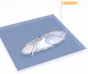 Places with similar names to Sehwa-ri, Korea, South ::
Disclaimer :: Information on this page comes without warranty of any kind |
||
|
Where is Sehwa-ri? Elevation and coordinates ::
Latitude (lat): 33°31'0"N Longitude (lon): 126°52'0"E
Elevation (approx.): 16m (map arrows pan, magnifying glasses zoom) |
||
|
Visiting Sehwa-ri? Hotel/Accommodation ::
Book a hotel in Sehwa-ri Travel Guide ::
rental cars ::
car rental offers GPS waypoint ::
download a GPX waypoint (PoI) of Sehwa-ri for your GPS receiver
|
||