|
search place name
|
||
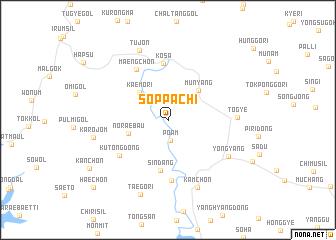
Soppach'i (Kyŏngsang, Korea, South)Soppach'i is a town in the Kyŏngsang region of Korea, South. An overview map of the region around Soppach'i is displayed below.
regional and 3d topo map of Soppach'i, Korea, South ::
Soppach'i airports ::
The nearest airport is YEC - Yechon Yecheon, located 63.3 km west of Soppach'i.
Other airports nearby include KPO - Pohang (85.6 km south), TAE - Taegu Daegu Ab (96.5 km south), KAG - Kangnung Gangneung (117.2 km north), USN - Ulsan (125.7 km south), Nearby towns ::
P'oam (2.3km south) //
Kaemŏ-ri (4.0km north west) //
Munyang (4.2km north east) //
Nŏraebau (3.9km south west) //
Sindang (5.7km south) //
Kosa (6.4km north) //
Maeng-ch'on (6.3km north west) //
Kut'ong-dong (5.8km south west) //
Soch'ŏng-dong (6.8km south) //
Togye (6.2km east) //
Yŏngyang (6.8km south east) //
Kamch'ŏn (8.0km south) //
Tujŏn (8.2km north) //
Karŏjŏm (6.9km west) //
Taegŏri (8.7km south) //
Kan-ch'on (8.9km south west) //
Haech'ŏn (10.0km south west) //
[all distances 'as the bird flies' and approximate]  Places with similar names to Soppach'i, Korea, South ::
// Supych (RU)
// Sypuchi (RU)
// Saopa Chai (MM)
// Saopa Chai (MM)
// Spich (DE)
// Spich (DE)
// Spítia (GR)
// Sapiechów (PL)
// Sępichów (PL)
// Sępochów (PL)
Disclaimer :: Information on this page comes without warranty of any kind |
||
|
Where is Soppach'i? Elevation and coordinates ::
Latitude (lat): 36°42'4"N Longitude (lon): 129°3'28"E
Elevation (approx.): 287m (map arrows pan, magnifying glasses zoom) |
||
|
Visiting Soppach'i? Hotel/Accommodation ::
Book a hotel in Soppach'i Travel Guide ::
rental cars ::
car rental offers GPS waypoint ::
download a GPX waypoint (PoI) of Soppach'i for your GPS receiver
|
||