|
search place name
|
||
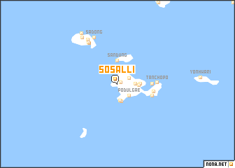
Sŏsal-li (Kyŏngsang, Korea, South)Sŏsal-li is a town in the Kyŏngsang region of Korea, South. An overview map of the region around Sŏsal-li is displayed below.
regional and 3d topo map of Sŏsal-li, Korea, South ::
Sŏsal-li airports ::
The nearest airport is RSU - Yeosu, located 61.0 km north west of Sŏsal-li.
Other airports nearby include PUS - Kimhae Gimhae Intl (88.4 km north east), TSJ - Tsushima (108.0 km east), KWJ - Kwangju Gwangju (141.2 km north west), TAE - Taegu Daegu Ab (145.1 km north), Nearby towns ::
Tŏk-tong (0.5km north east) //
To-dong (1.9km north) //
Ch'ŏngsa (1.8km north east) //
Pŏdŭlgae (2.4km south east) //
Yangch'on (2.7km south) //
Ŭp-tong (2.4km east) //
Sŏsang-ni (2.9km south) //
Tonghang-ni (2.9km east) //
Chabup'o (3.0km east) //
Sandŭng (3.7km north) //
Yap'o (4.6km east) //
Oksŏm (4.9km east) //
Nojŏk (4.9km east) //
Tanch'op'o (5.2km east) //
Ch'ŏngsŏk (7.4km north west) //
Kujŏn (7.6km north west) //
Sadong (8.0km north) //
Tumi-ri (8.0km north west) //
Chŏlge (8.7km north west) //
Hang-ni (9.3km north west) //
[all distances 'as the bird flies' and approximate]  Places with similar names to Sŏsal-li, Korea, South ::
Disclaimer :: Information on this page comes without warranty of any kind |
||
|
Where is Sŏsal-li? Elevation and coordinates ::
Latitude (lat): 34°38'0"N Longitude (lon): 128°14'0"E
Elevation (approx.): -32768m (map arrows pan, magnifying glasses zoom) |
||
|
Visiting Sŏsal-li? Hotel/Accommodation ::
Book a hotel in Sŏsal-li Travel Guide ::
rental cars ::
car rental offers GPS waypoint ::
download a GPX waypoint (PoI) of Sŏsal-li for your GPS receiver
|
||