|
search place name
|
||
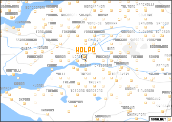
Wŏlp'o (Korea, South)Wŏlp'o is a town in Korea, South. An overview map of the region around Wŏlp'o is displayed below.
regional and 3d topo map of Wŏlp'o, Korea, South ::
Wŏlp'o airports ::
The nearest airport is KUB - Kunsan Ab, located 22.7 km west of Wŏlp'o.
Other airports nearby include KWJ - Kwangju Gwangju (87.8 km south), OSN - Osan Ab (131.1 km north), RSU - Yeosu (137.3 km south east), YEC - Yechon Yecheon (155.5 km north east), Nearby towns ::
Sin'gi-ri (0.0km north) //
Naesin (1.9km south) //
Hagwang (1.5km west) //
Wŏndu (1.5km west) //
Sinji-ri (2.4km north east) //
Chŏpsan-ni (2.4km north west) //
Sinch'ang (2.4km south west) //
Tongjisal-li (2.7km south west) //
Kyesan (3.7km north) //
Namch'am (3.0km east) //
Pukch'am (3.0km east) //
Sinch'ang (3.0km west) //
Pokkyo-ri (3.0km west) //
Taesin (3.7km south) //
Chusan (4.0km north) //
Chesŏng-ni (3.5km south east) //
Changjwa (3.5km north west) //
Kwadong (4.0km south) //
Songji-dong (4.0km south) //
Sulsal-li (4.6km north) //
Kwansang-ni (5.1km south) //
Chemal (4.8km south east) //
Sot'o (4.8km south west) //
Sangdae (5.6km south) //
Sŏk-tong (5.6km south) //
Sang-ni (4.5km west) //
Hoebok (4.5km east) //
Kongdŏng-ni (4.8km south east) //
Mahyŏl-li (4.9km south east) //
[all distances 'as the bird flies' and approximate]  Places with similar names to Wŏlp'o, Korea, South ::
Disclaimer :: Information on this page comes without warranty of any kind |
||
|
Where is Wŏlp'o? Elevation and coordinates ::
Latitude (lat): 35°55'0"N Longitude (lon): 126°52'0"E
Elevation (approx.): 7m (map arrows pan, magnifying glasses zoom) |
||
|
Visiting Wŏlp'o? Hotel/Accommodation ::
Book a hotel in Wŏlp'o Travel Guide ::
rental cars ::
car rental offers GPS waypoint ::
download a GPX waypoint (PoI) of Wŏlp'o for your GPS receiver
|
||