|
search place name
|
||
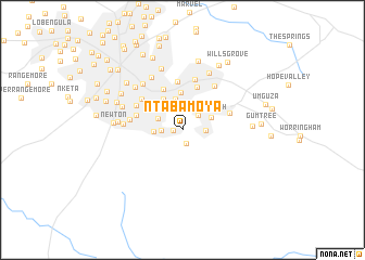
Ntaba Moya (Matabeleland North, Zimbabwe)Ntaba Moya is a town in the Matabeleland North region of Zimbabwe. An overview map of the region around Ntaba Moya is displayed below.
regional and 3d topo map of Ntaba Moya, Zimbabwe ::
Ntaba Moya airports ::
The nearest airport is BUQ - Bulawayo J M Nkomo Intl, located 23.4 km north of Ntaba Moya.
Other airports nearby include GWE - Gwert Gweru Thornhill (155.3 km north east), FRW - Francistown (159.2 km south west), PKW - Selebi-phikwe Selebi Phikwe (219.4 km south), WKM - Hwange National Park (245.2 km north west), Nearby towns ::
Southdale (0.9km west) //
Douglasdale (1.4km south) //
Riverside South (2.1km north east) //
Intini (2.1km west) //
Waterford (2.2km east) //
Burnside (2.6km north west) //
Munda (2.8km west) //
Fortunes Gate (3.2km north) //
Willsgrove (3.1km north east) //
Lakeside (3.7km north west) //
Matsheumhlope (3.9km north) //
White Star (3.8km north west) //
Hillside East (4.6km north west) //
Riverside Estates (4.6km north) //
Matsheumhlope Lots (5.0km north) //
Hillside South (4.7km west) //
Manningdale (4.9km east) //
Hillside (5.1km north west) //
Riverside North (5.3km north) //
Whitecairns (5.2km north west) //
Granite Park (5.2km west) //
Lockview (5.5km north east) //
Four Winds (5.7km west) //
Ilanda (6.1km north west) //
Malindela (6.1km north west) //
Sunninghill (6.4km north east) //
Hillcrest (6.4km north west) //
Eloana (6.3km west) //
Hillside West (6.3km west) //
[all distances 'as the bird flies' and approximate]  Places with similar names to Ntaba Moya, Zimbabwe :: Disclaimer :: Information on this page comes without warranty of any kind |
||
|
Where is Ntaba Moya? Elevation and coordinates ::
Latitude (lat): 20°13'40"S Longitude (lon): 28°38'17"E
Elevation (approx.): 1440m (map arrows pan, magnifying glasses zoom) |
||
|
Visiting Ntaba Moya? Hotel/Accommodation ::
Book a hotel in Ntaba Moya Travel Guide ::
Buy a travel guide for Zimbabwe rental cars ::
car rental offers GPS waypoint ::
download a GPX waypoint (PoI) of Ntaba Moya for your GPS receiver
|
||