|
search place name
|
||
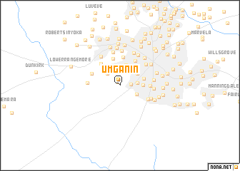
Umganin (Matabeleland North, Zimbabwe)Umganin is a town in the Matabeleland North region of Zimbabwe. An overview map of the region around Umganin is displayed below.
regional and 3d topo map of Umganin, Zimbabwe ::
Umganin airports ::
The nearest airport is BUQ - Bulawayo J M Nkomo Intl, located 22.2 km north east of Umganin.
Other airports nearby include FRW - Francistown (153.1 km south west), GWE - Gwert Gweru Thornhill (162.8 km north east), PKW - Selebi-phikwe Selebi Phikwe (218.2 km south), WKM - Hwange National Park (235.7 km north west), Nearby towns ::
Nketa (0.5km north west) //
Bellevue (1.6km east) //
Tshabalala (2.5km north) //
Nkulumane (2.6km north west) //
Southwold (2.6km east) //
Newton West (2.9km south east) //
Donnington (3.1km north east) //
Sizinda (3.3km north) //
Montrose (3.5km east) //
Barham Green (3.7km east) //
Kelvin West (4.3km north) //
Kelvin East (4.4km north) //
Westgate (4.4km north east) //
Bellevue (4.4km north west) //
Rangemore (4.5km north west) //
Morningside (4.5km east) //
Newton (4.7km south east) //
Upper Rangemore (4.7km west) //
Belmont (5.1km north east) //
Hillside West (5.0km east) //
Greenhill (5.0km east) //
Eloana (5.0km south east) //
Kelvin North (5.3km north) //
Hyde Park (5.3km north west) //
Mpopomo South (5.5km north) //
Steeldale (5.4km north east) //
Westondale (5.5km north) //
Raylton (5.6km north east) //
Iminyela (5.9km north) //
[all distances 'as the bird flies' and approximate] 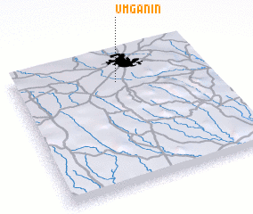 Places with similar names to Umganin, Zimbabwe :: Disclaimer :: Information on this page comes without warranty of any kind |
||
|
Where is Umganin? Elevation and coordinates ::
Latitude (lat): 20°12'6"S Longitude (lon): 28°32'4"E
Elevation (approx.): 1369m (map arrows pan, magnifying glasses zoom) |
||
|
Visiting Umganin? Hotel/Accommodation ::
Book a hotel in Umganin Travel Guide ::
Buy a travel guide for Zimbabwe rental cars ::
car rental offers GPS waypoint ::
download a GPX waypoint (PoI) of Umganin for your GPS receiver
|
||