|
search place name
|
||
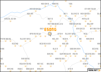
Esong (Equatorial Guinea)Esong is a town in Equatorial Guinea. An overview map of the region around Esong is displayed below.
regional and 3d topo map of Esong, Equatorial Guinea ::
Esong airports ::
The nearest airport is BMM - Bitam, located 55.5 km east of Esong.
Other airports nearby include OYE - Oyem (93.2 km south east), BSG - Bata (135.6 km west), YAO - Yaounde Ville (195.3 km north), DLA - Douala (249.8 km north west), Nearby towns ::
Mesiá (1.9km west) //
Niemitang (2.6km north west) //
Melen (2.6km south east) //
Assia (3.7km north) //
Oveng (3.7km west) //
Atom (3.7km east) //
Aseosi (3.7km east) //
Aconekién (4.1km south west) //
Meyo Biboulou (4.1km north east) //
Mindyimitom (5.2km south east) //
Meyo (5.6km north) //
Afanengui (5.6km west) //
Alen (5.9km south) //
Acam (5.9km east) //
Mocoa (6.7km south east) //
Alen (7.4km south) //
Oveng (7.4km south) //
Abanengui (7.4km east) //
Nloayong (7.4km east) //
Egon (7.6km west) //
Esalan (7.6km west) //
Alen (8.3km north east) //
Dumanduin (9.3km south east) //
Biyi (9.3km north east) //
Mbaé (9.3km north east) //
Andom (10.5km south east) //
Mékak (10.5km north west) //
[all distances 'as the bird flies' and approximate] 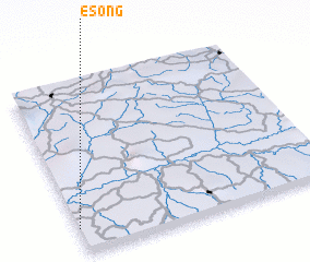 Places with similar names to Esong, Equatorial Guinea ::
Disclaimer :: Information on this page comes without warranty of any kind |
||
|
Where is Esong? Elevation and coordinates ::
Latitude (lat): 2°9'0"N Longitude (lon): 11°0'0"E
Elevation (approx.): 591m (map arrows pan, magnifying glasses zoom) |
||
|
Visiting Esong? Hotel/Accommodation ::
Book a hotel in Esong Travel Guide ::
rental cars ::
car rental offers GPS waypoint ::
download a GPX waypoint (PoI) of Esong for your GPS receiver
|
||