|
search place name
|
||
Ngonsoc (Equatorial Guinea)Ngonsoc is a town in Equatorial Guinea. An overview map of the region around Ngonsoc is displayed below.
regional and 3d topo map of Ngonsoc, Equatorial Guinea ::

Ngonsoc airports ::
The nearest airport is BMM - Bitam, located 34.4 km north east of Ngonsoc.
Other airports nearby include OYE - Oyem (52.7 km south east), BSG - Bata (160.7 km west), YAO - Yaounde Ville (218.1 km north), MKU - Makokou (232.7 km south east), Nearby towns ::
Etegueveiñ (1.9km east) //
Acam (3.7km south) //
Mban (3.7km east) //
Esong (3.7km west) //
Angoc (4.1km north west) //
Milang (4.1km north east) //
Macac (5.6km south) //
Bicuama (5.9km west) //
Ebang (5.9km north) //
Mabaiñ (5.9km north) //
Mabomo (5.9km north) //
Mandoc (5.9km south) //
Onsalom (5.9km west) //
Eyina (5.9km east) //
Ndumuc (6.7km north west) //
Ebe (6.7km north east) //
Ncum (7.4km west) //
Atut (7.4km east) //
Matamasi (7.6km south) //
Malem (7.6km north) //
Abiara (7.6km west) //
Nguanden (7.9km south west) //
Ndogo (9.3km north east) //
Ebo (10.5km north west) //
Macomo (10.5km north east) //
[all distances 'as the bird flies' and approximate] 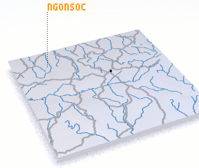 Places with similar names to Ngonsoc, Equatorial Guinea ::
Disclaimer :: Information on this page comes without warranty of any kind |
||
|
Where is Ngonsoc? Elevation and coordinates ::
Latitude (lat): 1°53'0"N Longitude (lon): 11°15'0"E
Elevation (approx.): 596m (map arrows pan, magnifying glasses zoom) |
||
|
Visiting Ngonsoc? Hotel/Accommodation ::
Book a hotel in Ngonsoc Travel Guide ::
rental cars ::
car rental offers GPS waypoint ::
download a GPX waypoint (PoI) of Ngonsoc for your GPS receiver
|
||