|
search place name
|
||
Gahutu (Polynésie Française, French Polynesia)Gahutu is a town in the Polynésie Française region of French Polynesia. An overview map of the region around Gahutu is displayed below.
regional and 3d topo map of Gahutu, French Polynesia ::
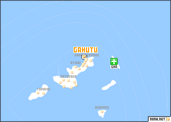
Gahutu airports ::
The nearest airport is GMR - Totegegie, located 5.8 km east of Gahutu.
Nearby towns ::
Vaitinoua (0.1km north) //
Taku (0.4km south west) //
Gahutu Tenohu (0.5km north east) //
Gataha (0.9km south west) //
Atirikigaro (1.1km south) //
Akaputu (1.1km east) //
Kairori (1.2km south west) //
Apeakava (2.1km south west) //
Atihoi (2.4km south west) //
Kirimiro (3.7km south west) //
Rikitea (5.2km south west) //
Rouru (5.6km south) //
Gatavaké (5.5km south west) //
Atiaoha (6.1km south west) //
Atituiti (6.4km south west) //
Kokohue (7.0km south west) //
Ganoa (7.2km south west) //
[all distances 'as the bird flies' and approximate] 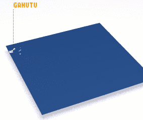 Places with similar names to Gahutu, French Polynesia ::
Disclaimer :: Information on this page comes without warranty of any kind |
||
|
Where is Gahutu? Elevation and coordinates ::
Latitude (lat): 23°4'42"S Longitude (lon): 134°56'50"W
Elevation (approx.): -32768m (map arrows pan, magnifying glasses zoom) |
||
|
Visiting Gahutu? Hotel/Accommodation ::
Book a hotel in Gahutu Travel Guide ::
rental cars ::
car rental offers GPS waypoint ::
download a GPX waypoint (PoI) of Gahutu for your GPS receiver
|
||