|
search place name
|
||
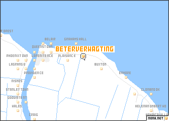
Beterverwagting (Demerara-Mahaica, Guyana)Beterverwagting is a town in the Demerara-Mahaica region of Guyana. An overview map of the region around Beterverwagting is displayed below.
regional and 3d topo map of Beterverwagting, Guyana ::
Nearby towns ::
Plaisance (3.7km west) //
Grahams Hall (4.1km north west) //
Courida Park (4.1km north west) //
Buxton (4.1km south east) //
Kitty (7.6km west) //
Campbellville (7.6km west) //
Lamaha Gardens (7.6km west) //
Bel Air Park (7.6km west) //
Newtown (7.6km west) //
Lodge (7.6km west) //
Blygezight (7.6km west) //
Bel Air Gardens (8.2km north west) //
Bel Air (8.2km north west) //
Bel Air Springs (8.2km north west) //
Subryanville (8.2km north west) //
Prashad Nagar (8.2km north west) //
Blygezight Gardens (8.2km north west) //
[all distances 'as the bird flies' and approximate]  Places with similar names to Beterverwagting, Guyana :: Disclaimer :: Information on this page comes without warranty of any kind |
||
|
Where is Beterverwagting? Elevation and coordinates ::
Latitude (lat): 6°48'0"N Longitude (lon): 58°4'0"W
Elevation (approx.): 4m (map arrows pan, magnifying glasses zoom) |
||
|
Visiting Beterverwagting? Hotel/Accommodation ::
Book a hotel in Beterverwagting Travel Guide ::
Buy a travel guide for Guyana rental cars ::
car rental offers GPS waypoint ::
download a GPX waypoint (PoI) of Beterverwagting for your GPS receiver
|
||