|
search place name
|
||
Water Valley (Saint Thomas, Jamaica)Water Valley is a town in the Saint Thomas region of Jamaica. An overview map of the region around Water Valley is displayed below.
regional and 3d topo map of Water Valley, Jamaica ::

Water Valley airports ::
The nearest airport is POT - Port Antonio Ken Jones, located 40.1 km north west of Water Valley.
Other airports nearby include KIN - Kingston Norman Manley Intl (43.5 km west), KTP - Kingston Tinson Pen (48.6 km west), OCJ - Ocho Rios Boscobel (85.9 km north west), MBJ - Montego Bay Sangster Intl (176.6 km north west), Nearby towns ::
Lyssons (1.9km north) //
Montpelier (1.9km north) //
Belfast (1.9km north) //
Beckford Town (2.6km north east) //
Stanton (2.6km north west) //
Readers Pen (2.6km north west) //
Elgin Town (2.6km north west) //
Oxford (3.5km east) //
Prospect (3.5km east) //
Needham Pen (4.1km north east) //
Johns Town (4.0km north east) //
Red Hill (4.0km north west) //
Morant Bay (4.0km north west) //
Friendship (5.3km west) //
Leith Hall (5.3km east) //
Carry Hall (5.6km north) //
Wilmington (5.8km north) //
Morant (6.5km north west) //
Unity Valley (6.6km north east) //
Panton Town (6.6km north east) //
Stony Gut (6.6km north west) //
Old Pera (7.1km east) //
Rozelle (7.1km west) //
Potosi (7.6km north) //
Bowden (7.3km east) //
Belvedere (7.3km west) //
Airy Castle (7.7km north east) //
Highland Castle (7.7km north west) //
Spring Garden (7.7km north west) //
[all distances 'as the bird flies' and approximate] 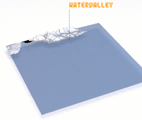 Places with similar names to Water Valley, Jamaica ::
// Water Valley (US)
// Waterfall (US)
// Waterville (US)
// Watervale (US)
// Waterville (US)
// Water Valley (US)
// Waterville (US)
// Water Fall (ZA)
// Waterval (ZA)
// Waterval (ZA)
Disclaimer :: Information on this page comes without warranty of any kind |
||
|
Where is Water Valley? Elevation and coordinates ::
Latitude (lat): 17°52'0"N Longitude (lon): 76°23'0"W
Elevation (approx.): -32768m (map arrows pan, magnifying glasses zoom) |
||
|
Visiting Water Valley? Hotel/Accommodation ::
Book a hotel in Water Valley Travel Guide ::
Buy a travel guide for Jamaica rental cars ::
car rental offers GPS waypoint ::
download a GPX waypoint (PoI) of Water Valley for your GPS receiver
|
||