|
search place name
|
||
A Ta Chai (Laos)A Ta Chai is a town in Laos. An overview map of the region around A Ta Chai is displayed below.
regional and 3d topo map of A Ta Chai, Laos ::

A Ta Chai airports ::
The nearest airport is LPQ - Luang Prabang Luang Phabang Intl, located 168.2 km south of A Ta Chai.
Nearby towns ::
Ban Samphanxai (1.0km north) //
Hôi Khung (1.9km north) //
Mu C'chi (2) (1.9km south) //
Ban Eupeuching (2.6km south east) //
Ban Sanamphongkou (2.8km west) //
Ban Mouchiteuka (3.4km east) //
P'u Mông (4.1km north west) //
Ban Sènkang-Mai (4.5km north east) //
Ban Chaohosentham (5.0km south) //
A Cho Ban Nôi (5.1km south east) //
Ban Phoumon (5.1km north west) //
Phou Pialông (5.1km east) //
Mu C'chi (4) (5.2km east) //
Phu Ly (5.8km north) //
Ta Pia (5.8km north) //
Ban Sèn-In-Noy (5.9km north) //
Ban Pouli-Kao (5.8km south west) //
Ban Sènkang-Kao (7.1km north east) //
Thau P'a (7.4km south) //
Ban Cheuyya (7.0km east) //
A Tsông (7.1km east) //
Tông Chông Chai (7.6km north east) //
Ban Aychônampok (8.2km south west) //
Ban Aychô (8.6km north) //
Ban Sèn-In (8.8km north) //
Ban Chamè (8.8km south) //
Ban Gnangpa (9.1km south) //
Ban Lixingxô (8.8km south east) //
Yot Nam Quang (8.9km south west) //
[all distances 'as the bird flies' and approximate] 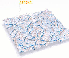 Places with similar names to A Ta Chai, Laos ::
Disclaimer :: Information on this page comes without warranty of any kind |
||
|
Where is A Ta Chai? Elevation and coordinates ::
Latitude (lat): 21°25'0"N Longitude (lon): 102°8'0"E
Elevation (approx.): 1183m (map arrows pan, magnifying glasses zoom) |
||
|
Visiting A Ta Chai? Hotel/Accommodation ::
Book a hotel in A Ta Chai Travel Guide ::
Buy a travel guide for Laos rental cars ::
car rental offers GPS waypoint ::
download a GPX waypoint (PoI) of A Ta Chai for your GPS receiver
|
||