|
search place name
|
||
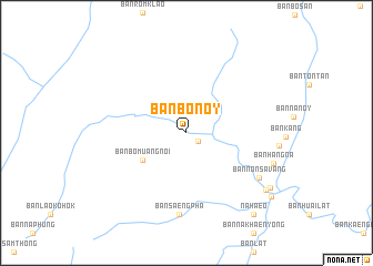
Ban Bonoy (Xaignabouli, Laos)Ban Bonoy is a town in the Xaignabouli region of Laos. An overview map of the region around Ban Bonoy is displayed below.
regional and 3d topo map of Ban Bonoy, Laos ::
Ban Bonoy airports ::
The nearest airport is LOE - Loei, located 77.2 km east of Ban Bonoy.
Other airports nearby include PRH - Phrae (109.5 km north west), PHS - Phitsanulok (115.5 km south west), VTE - Vientiane Wattay Intl (171.9 km east), LPT - Lampang (177.7 km north west), Nearby towns ::
Ban Bo Muang Noi (1.4km south east) //
Ban Nabonoy (1.4km south east) //
Ban Bo Muang Noi (5.0km south west) //
Ban Saeng Pha (8.3km south) //
Ban Nônsavang (8.3km south east) //
Ban Hang-Na (8.9km east) //
Ban Muangphra (9.5km south east) //
Ban Natha (9.8km south east) //
Ban Na Haeo (10.5km south east) //
Na Haeo (10.5km south east) //
Ban Muang Phrae (10.4km south east) //
Ban Na Pho (10.4km south east) //
Ban Phon Prasat (10.4km south east) //
[all distances 'as the bird flies' and approximate] 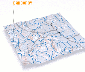 Places with similar names to Ban Bonoy, Laos ::
// Banaban (PH)
// Banaban (PH)
// Banaban (PH)
// Banay-Banay (PH)
// Banaybanay (PH)
// Banaybanay (PH)
// Banaybanay (PH)
// Banaybanay (PH)
// Banaybanay (PH)
// Banban (PH)
Disclaimer :: Information on this page comes without warranty of any kind |
||
|
Where is Ban Bonoy? Elevation and coordinates ::
Latitude (lat): 17°33'27"N Longitude (lon): 101°0'22"E
Elevation (approx.): 554m (map arrows pan, magnifying glasses zoom) |
||
|
Visiting Ban Bonoy? Hotel/Accommodation ::
Book a hotel in Ban Bonoy Travel Guide ::
Buy a travel guide for Laos rental cars ::
car rental offers GPS waypoint ::
download a GPX waypoint (PoI) of Ban Bonoy for your GPS receiver
|
||