|
search place name
|
||
Ban Hatcha (Bokéo, Laos)Ban Hatcha is a town in the Bokéo region of Laos. An overview map of the region around Ban Hatcha is displayed below.
regional and 3d topo map of Ban Hatcha, Laos ::

Ban Hatcha airports ::
The nearest airport is THL - Tachilek Tachileik, located 44.4 km south west of Ban Hatcha.
Other airports nearby include KET - Kengtung (91.6 km north west), MOG - Mong Hsat (108.4 km west), LPQ - Luang Prabang Luang Phabang Intl (217.7 km south east), Nearby towns ::
Ban Houadoy (1.7km west) //
Ban Sòngkèo (1.8km north east) //
Ta Makti (4.1km west) //
Ta Sang (4.3km north west) //
Ban Chakham (4.5km east) //
Ban Oko (4.7km north east) //
Wān Ai-ta-ho-lēng (5.8km north) //
Wān Ai-ngün (5.8km north west) //
Wān Ra-sa-kiao (6.0km north) //
Wān Tau Mē-hkawng (6.1km north) //
Wān Nawngkwang (5.8km west) //
Wān Ai-ngunhkam-u (6.4km north) //
Ban Veupó (7.5km south east) //
Ban Houaylai (8.4km south) //
Wān Htawngmaw-tem (8.4km north) //
Ban Sènphonuang (8.0km east) //
Wān Namhküm (8.3km north west) //
Wān Tā-hang (8.6km north west) //
Ban Xiang (8.7km east) //
Wān Hsenhkamhpu (9.3km north west) //
Wān Namhsan (9.6km north west) //
[all distances 'as the bird flies' and approximate] 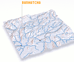 Places with similar names to Ban Hatcha, Laos ::
Disclaimer :: Information on this page comes without warranty of any kind |
||
|
Where is Ban Hatcha? Elevation and coordinates ::
Latitude (lat): 20°43'45"N Longitude (lon): 100°16'19"E
Elevation (approx.): 501m (map arrows pan, magnifying glasses zoom) |
||
|
Visiting Ban Hatcha? Hotel/Accommodation ::
Book a hotel in Ban Hatcha Travel Guide ::
Buy a travel guide for Laos rental cars ::
car rental offers GPS waypoint ::
download a GPX waypoint (PoI) of Ban Hatcha for your GPS receiver
|
||