|
search place name
|
||
Ban Hatxao (Louangphrabang, Laos)Ban Hatxao is a town in the Louangphrabang region of Laos. An overview map of the region around Ban Hatxao is displayed below.
regional and 3d topo map of Ban Hatxao, Laos ::

Ban Hatxao airports ::
The nearest airport is LPQ - Luang Prabang Luang Phabang Intl, located 90.7 km south west of Ban Hatxao.
Nearby towns ::
Ban Sôphoun (2.7km south west) //
Ban Sôpvan (3.1km north east) //
Ban Phathok (3.2km south) //
Ban Houaylan (3.6km east) //
Ban Nong-Ian (4.5km south) //
Ban Pakbak (5.5km west) //
Ban Houaykhong (5.8km east) //
Ban Kong (5.9km west) //
Ban Nalong (6.4km north west) //
Ban Houayhoy (6.5km north) //
Ban Hin-Ong (6.4km north west) //
Ban Houaylèk (6.7km south east) //
Tong Veng (6.7km east) //
Tamong (6.7km east) //
Kie Kang (7.4km north east) //
Pang Fat (7.7km north) //
Ban Hathouan (7.5km south west) //
Ban Phônxiang-Tai (8.1km north) //
Ban Sôpkong (8.0km north) //
Ban Houay Moum Noi (8.1km south east) //
Ban Lakhon (8.2km west) //
Ban Houayxong (9.0km south east) //
Ban Mokdou (9.0km north east) //
Ban Houaypong (9.2km south east) //
Ban Longkham (10.1km south east) //
Ban Kioulôm (10.2km north west) //
Ban Donkhoun (10.5km south west) //
[all distances 'as the bird flies' and approximate] 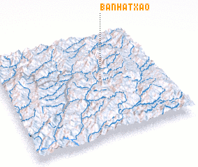 Places with similar names to Ban Hatxao, Laos ::
// Benahadux (ES)
// Ban Hatxa (LA)
// Ban Hatxa (LA)
// Ban Hatxa (LA)
// Ban Hatxai (LA)
// Ban Hatxeuy (LA)
Disclaimer :: Information on this page comes without warranty of any kind |
||
|
Where is Ban Hatxao? Elevation and coordinates ::
Latitude (lat): 20°35'1"N Longitude (lon): 102°38'10"E
Elevation (approx.): 344m (map arrows pan, magnifying glasses zoom) |
||
|
Visiting Ban Hatxao? Hotel/Accommodation ::
Book a hotel in Ban Hatxao Travel Guide ::
Buy a travel guide for Laos rental cars ::
car rental offers GPS waypoint ::
download a GPX waypoint (PoI) of Ban Hatxao for your GPS receiver
|
||