|
search place name
|
||
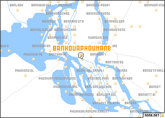
Ban Houaphouman (1) (Laos)Ban Houaphouman (1) is a town in Laos. An overview map of the region around Ban Houaphouman (1) is displayed below.
regional and 3d topo map of Ban Houaphouman (1), Laos ::
Ban Houaphouman (1) airports ::
The nearest airport is PKZ - Pakse, located 116.1 km north of Ban Houaphouman (1).
Nearby towns ::
Ban Hinsiou (0.0km north) //
Ban Dontan (1.9km south) //
Ban Houa (1.9km south) //
Ban Houaphouman (2) (2.6km south east) //
Ban Hat (3.6km east) //
Ban Houay (3.6km east) //
Ban Houa Donchi (3.7km south) //
Ban Khamao Tiak (3.6km west) //
Ban Hangkhông (4.0km south east) //
Ban Dua (4.0km south east) //
Ban Houalôppadi (4.1km south east) //
Ban Na (4.0km north east) //
Phumĭ Kâmpóng Poŭthĭ (4.0km south west) //
Ban Phoumaktong (4.1km north west) //
Muang Sèn (4.0km north west) //
Muang Không (5.2km north east) //
Ban Hangdonlékfai (5.2km north west) //
Ban Louang (5.2km north west) //
Ban Khamao Kang (5.4km west) //
Phumĭ Kâmpóng Srâlau (5.4km west) //
Ban Thahai (5.4km west) //
Ban Phôn (5.7km east) //
Ban Sala (5.7km east) //
Ban Lôppadi Kang (5.8km south) //
Ban Veunkhao (5.7km east) //
Ban Hangkhamao (5.7km west) //
Ban Nôkkôk (5.7km east) //
Ban Long Kang (5.8km south) //
Ban Sèn-Hat (5.8km north) //
[all distances 'as the bird flies' and approximate] 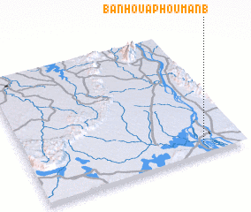 Places with similar names to Ban Houaphouman (1), Laos :: Disclaimer :: Information on this page comes without warranty of any kind |
||
|
Where is Ban Houaphouman (1)? Elevation and coordinates ::
Latitude (lat): 14°5'0"N Longitude (lon): 105°49'0"E
Elevation (approx.): 93m (map arrows pan, magnifying glasses zoom) |
||
|
Visiting Ban Houaphouman (1)? Hotel/Accommodation ::
Book a hotel in Ban Houaphouman (1) Travel Guide ::
Buy a travel guide for Laos rental cars ::
car rental offers GPS waypoint ::
download a GPX waypoint (PoI) of Ban Houaphouman (1) for your GPS receiver
|
||