|
search place name
|
||
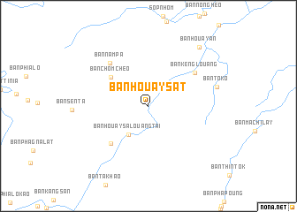
Ban Houaysat (Phôngsali, Laos)Ban Houaysat is a town in the Phôngsali region of Laos. An overview map of the region around Ban Houaysat is displayed below.
regional and 3d topo map of Ban Houaysat, Laos ::
Ban Houaysat airports ::
The nearest airport is LPQ - Luang Prabang Luang Phabang Intl, located 181.1 km south of Ban Houaysat.
Nearby towns ::
Ban Taliao-Noy (3.8km north west) //
Ban Houaysalouang-Tai (4.3km south west) //
Ban Tangan (5.2km north west) //
Ban Chomchèo (5.7km north west) //
Ban Souamnay (6.5km south west) //
Ban Kènglouang (6.8km north east) //
Ban Nampa (7.0km north west) //
Ban Toko (8.4km east) //
Ban Houay-An (9.5km north east) //
[all distances 'as the bird flies' and approximate] 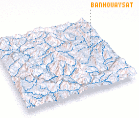 Places with similar names to Ban Houaysat, Laos ::
// Ban Huai Sa-at (TH)
// Ban Huai Saet (TH)
// Ban Huai Sai (3) (TH)
// Ban Huai Sai Tai (TH)
// Ban Huai Sai Tai (TH)
// Ban Huai So Tai (TH)
// Ban Houay Sada (LA)
// Ban Houaysat (LA)
// Ban Houaysat (LA)
// Ban Houaysata (LA)
Disclaimer :: Information on this page comes without warranty of any kind |
||
|
Where is Ban Houaysat? Elevation and coordinates ::
Latitude (lat): 21°25'52"N Longitude (lon): 102°46'1"E
Elevation (approx.): 569m (map arrows pan, magnifying glasses zoom) |
||
|
Visiting Ban Houaysat? Hotel/Accommodation ::
Book a hotel in Ban Houaysat Travel Guide ::
Buy a travel guide for Laos rental cars ::
car rental offers GPS waypoint ::
download a GPX waypoint (PoI) of Ban Houaysat for your GPS receiver
|
||