|
search place name
|
||
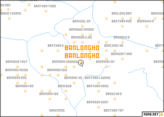
Ban Longho (Xiangkhoang, Laos)Ban Longho is a town in the Xiangkhoang region of Laos. An overview map of the region around Ban Longho is displayed below.
regional and 3d topo map of Ban Longho, Laos ::
Ban Longho airports ::
The nearest airport is LPQ - Luang Prabang Luang Phabang Intl, located 199.3 km west of Ban Longho.
Other airports nearby include VTE - Vientiane Wattay Intl (201.0 km south west), UTH - Udon Thani (239.2 km south west), HAN - Hanoi Noibai Intl (293.2 km north east), Nearby towns ::
Ban Ly Chang (1.9km north) //
Ban Longho (1.9km south) //
Bản Houei Pung (1.7km east) //
Ban Thammeu (2.5km south west) //
Bản Thằm Khúp (2.5km north east) //
Bản Houei Hang (2.5km north east) //
Bản Houei Lâu (3.7km north) //
Ban Houei Hay (4.1km north west) //
Ban Namkhaohou (4.0km south west) //
Bản Houei Xăng (4.0km north east) //
Ban Nong-O (5.1km south west) //
Bản Ba Ginh (5.1km north east) //
Bản Huôi Ten (5.2km east) //
Bản Houei Phong (5.6km north) //
Ban Pakpéng (5.8km south) //
Ban Samchè (5.8km south) //
Ban Thamdai (5.6km west) //
Bản Phia Xay (5.6km east) //
Bản Gia Nang (5.6km east) //
Bản Chành (5.8km north) //
Ban Phouseu (6.4km south west) //
Bản Ong Chinh (6.4km north east) //
Bản Cò Fat (6.6km north west) //
Ban Sôp-Hang (6.6km north west) //
Ban Thamlouang (6.6km south east) //
Bản Keo Lóm (7.4km north) //
Bản Chia Cha (7.2km east) //
Ban Moun (7.9km south west) //
Ban Koua (8.2km south west) //
[all distances 'as the bird flies' and approximate]  Places with similar names to Ban Longho, Laos ::
// Ban Lin Fa (TH)
// Ban Lin Fa (TH)
// Ban Alanphô (LA)
// Ban Langhô (LA)
// Ban Long Ho (LA)
// Ban Longho (LA)
// Ban Longhoy (LA)
// Bản Long Hệ (VN)
// Bản Long Ho (VN)
Disclaimer :: Information on this page comes without warranty of any kind |
||
|
Where is Ban Longho? Elevation and coordinates ::
Latitude (lat): 19°15'0"N Longitude (lon): 103°56'0"E
Elevation (approx.): 1252m (map arrows pan, magnifying glasses zoom) |
||
|
Visiting Ban Longho? Hotel/Accommodation ::
Book a hotel in Ban Longho Travel Guide ::
Buy a travel guide for Laos rental cars ::
car rental offers GPS waypoint ::
download a GPX waypoint (PoI) of Ban Longho for your GPS receiver
|
||