|
search place name
|
||
Ban Lôngthang-Kao (Phôngsali, Laos)Ban Lôngthang-Kao is a town in the Phôngsali region of Laos. An overview map of the region around Ban Lôngthang-Kao is displayed below.
regional and 3d topo map of Ban Lôngthang-Kao, Laos ::

Ban Lôngthang-Kao airports ::
The nearest airport is LPQ - Luang Prabang Luang Phabang Intl, located 182.3 km south of Ban Lôngthang-Kao.
Nearby towns ::
Ban Ômalouangthang (1.0km south) //
Ban Lôngthang-Mai (1.8km north east) //
Ban Phouxang-Mai (4.3km east) //
Ban Kaoxang (4.9km south) //
Ban Phoumon (5.0km north) //
Kong Nhiu (5.1km south west) //
Mao Kho Schang (5.1km south west) //
Ban Chakhamlu (5.6km west) //
Ban Namkhi (6.2km north east) //
Ban Nampông (6.4km south east) //
Ban Namlèng (6.7km north west) //
Ban Phouxang (7.0km south east) //
Ban Khamkhoun (7.2km south west) //
Ban Ômananam (7.6km south) //
Ban Khamkhoun (7.3km west) //
Ban Phoukhô (8.1km north east) //
Ban Kôkkhô (8.0km east) //
Tao Mai (8.2km west) //
Ban Phouxoum (8.6km north west) //
Ban Sènkham (8.5km south east) //
Ban Aychô (8.7km south west) //
Tông Chông Chai (9.5km south west) //
Ban Sanamphoumop (10.0km north east) //
BanHounxianghoung (10.9km north east) //
Ta Pia (11.5km south west) //
[all distances 'as the bird flies' and approximate] 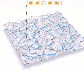 Places with similar names to Ban Lôngthang-Kao, Laos :: Disclaimer :: Information on this page comes without warranty of any kind |
||
|
Where is Ban Lôngthang-Kao? Elevation and coordinates ::
Latitude (lat): 21°32'36"N Longitude (lon): 102°13'26"E
Elevation (approx.): 1227m (map arrows pan, magnifying glasses zoom) |
||
|
Visiting Ban Lôngthang-Kao? Hotel/Accommodation ::
Book a hotel in Ban Lôngthang-Kao Travel Guide ::
Buy a travel guide for Laos rental cars ::
car rental offers GPS waypoint ::
download a GPX waypoint (PoI) of Ban Lôngthang-Kao for your GPS receiver
|
||