|
search place name
|
||
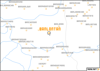
Ban Lontan (Phôngsali, Laos)Ban Lontan is a town in the Phôngsali region of Laos. An overview map of the region around Ban Lontan is displayed below.
regional and 3d topo map of Ban Lontan, Laos ::
Ban Lontan airports ::
The nearest airport is THL - Tachilek Tachileik, located 252.8 km south west of Ban Lontan.
Nearby towns ::
Ban Boké (4.5km north west) //
Ban Lanpa (4.6km north east) //
Ban Phouxa-Nua (5.6km south) //
Ban Khapousa (6.1km south) //
Ban Sôpkhing (6.7km south east) //
Ban Chénsan (7.8km north west) //
Ban Kheusan (8.4km west) //
Ban Salaoutya (8.8km west) //
Ban Phadèng-Noy (9.1km south west) //
Ban Ngay-Nua (9.7km south east) //
Ban Konsito (9.9km north east) //
[all distances 'as the bird flies' and approximate]  Places with similar names to Ban Lontan, Laos ::
// Bonlanden (DE)
// Bonlanden (DE)
// Ban Lantèn (LA)
// Ban Lantèn (LA)
// Ban Lan Tene (LA)
// Ban Lantouy-Noy (LA)
Disclaimer :: Information on this page comes without warranty of any kind |
||
|
Where is Ban Lontan? Elevation and coordinates ::
Latitude (lat): 21°54'15"N Longitude (lon): 101°50'31"E
Elevation (approx.): 976m (map arrows pan, magnifying glasses zoom) |
||
|
Visiting Ban Lontan? Hotel/Accommodation ::
Book a hotel in Ban Lontan Travel Guide ::
Buy a travel guide for Laos rental cars ::
car rental offers GPS waypoint ::
download a GPX waypoint (PoI) of Ban Lontan for your GPS receiver
|
||