|
search place name
|
||
Ban Lôppadi (Laos)Ban Lôppadi is a town in Laos. An overview map of the region around Ban Lôppadi is displayed below.
regional and 3d topo map of Ban Lôppadi, Laos ::

Ban Lôppadi airports ::
The nearest airport is PKZ - Pakse, located 125.6 km north of Ban Lôppadi.
Nearby towns ::
Ban Doutholathi (1.9km south) //
Ban Hang-Lôppadi (1.8km west) //
Ban Houasôm (2.6km north east) //
Ban Kèngkoum (2.6km north east) //
Ban Lôppadi Chok (2.6km north west) //
Ban Thaphao (3.7km north) //
Ban Houaydon-Gnang (3.6km east) //
Ban Mouang (4.1km north east) //
Ban Boungkhè (4.1km north west) //
Ban Xangphai (4.1km north west) //
Ban Donsang (4.0km south east) //
Phumĭ Kâmpóng Chrey (4.0km south west) //
Ban Nônsoung (5.2km north east) //
Ban Thakham (5.2km north east) //
Ban Sônlaviang (5.2km north east) //
Ban Lôppadi Kang (5.2km north west) //
Phumĭ Kâmpóng Preăh Ĕnt (5.2km south west) //
Phumĭ Thaphŏng (5.4km west) //
Ban Hatkhikhoay (5.4km east) //
Ban Dinchi (5.6km north) //
Phumĭ Kâmpóng Sœămeu (5.6km south) //
Ban Thaphô Tai (5.6km north) //
Ban Donsôm Tai (5.7km east) //
Ban Sôm (5.7km east) //
Khinak (6.6km north east) //
Ban Kadan (6.6km north east) //
Ban Houalôppadi (6.6km north west) //
Ban Phôn (7.4km north) //
Ban Sala (7.4km north) //
[all distances 'as the bird flies' and approximate] 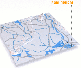 Places with similar names to Ban Lôppadi, Laos ::
Disclaimer :: Information on this page comes without warranty of any kind |
||
|
Where is Ban Lôppadi? Elevation and coordinates ::
Latitude (lat): 14°0'0"N Longitude (lon): 105°52'0"E
Elevation (approx.): 78m (map arrows pan, magnifying glasses zoom) |
||
|
Visiting Ban Lôppadi? Hotel/Accommodation ::
Book a hotel in Ban Lôppadi Travel Guide ::
Buy a travel guide for Laos rental cars ::
car rental offers GPS waypoint ::
download a GPX waypoint (PoI) of Ban Lôppadi for your GPS receiver
|
||