|
search place name
|
||
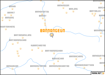
Ban Nangeun (Xaignabouli, Laos)Ban Nangeun is a town in the Xaignabouli region of Laos. An overview map of the region around Ban Nangeun is displayed below.
regional and 3d topo map of Ban Nangeun, Laos ::
Ban Nangeun airports ::
The nearest airport is LPQ - Luang Prabang Luang Phabang Intl, located 112.5 km east of Ban Nangeun.
Other airports nearby include THL - Tachilek Tachileik (157.5 km north west), PRH - Phrae (193.2 km south west), MOG - Mong Hsat (219.7 km north west), LPT - Lampang (226.9 km south west), Nearby towns ::
Ban Muangngeun (2.5km north west) //
Ban Khon (3.7km north west) //
Ban Phiangam (5.1km north west) //
Ban Yao Nong Kham (5.6km south) //
Ban Dimi (5.7km north west) //
Ban Huai Sai Khao (5.9km south west) //
Mu Ban Chao Yao (6.1km south west) //
Ban Dimi (6.8km north) //
Ban Kay (7.6km north west) //
Ban Huai Kon (8.1km south west) //
Ban Kio Chan (8.7km south) //
Ban Môksatou (9.1km north west) //
Ban Nam Chang (11.0km south east) //
[all distances 'as the bird flies' and approximate]  Places with similar names to Ban Nangeun, Laos ::
// Binningen (CH)
// Behningen (DE)
// Beiningen (DE)
// Binningen (DE)
// Binningen (DE)
// Ban Nong Ian (TH)
// Ban Nong Ian (TH)
// Ban Nong Ian (TH)
// Ban Nong Ian (TH)
// Ban Nong Ian (TH)
Disclaimer :: Information on this page comes without warranty of any kind |
||
|
Where is Ban Nangeun? Elevation and coordinates ::
Latitude (lat): 19°37'1"N Longitude (lon): 101°7'44"E
Elevation (approx.): 529m (map arrows pan, magnifying glasses zoom) |
||
|
Visiting Ban Nangeun? Hotel/Accommodation ::
Book a hotel in Ban Nangeun Travel Guide ::
Buy a travel guide for Laos rental cars ::
car rental offers GPS waypoint ::
download a GPX waypoint (PoI) of Ban Nangeun for your GPS receiver
|
||