|
search place name
|
||
Ban Pakgnong (Louangphrabang, Laos)Ban Pakgnong is a town in the Louangphrabang region of Laos. An overview map of the region around Ban Pakgnong is displayed below.
regional and 3d topo map of Ban Pakgnong, Laos ::

Ban Pakgnong airports ::
The nearest airport is LPQ - Luang Prabang Luang Phabang Intl, located 143.7 km south west of Ban Pakgnong.
Nearby towns ::
Ban Phônsouk (2.7km north east) //
Tao Louk (3.2km north west) //
Ban Chomchiang-Nua (4.1km west) //
Tiom Tieng (4.4km west) //
Ban Namlouang (5.0km north east) //
Ban Houayhè (5.5km south) //
Ban Chomchiang-Kang (5.6km south west) //
Tiom Tieng Khang (5.8km south west) //
Ban Ômmôk (6.0km north west) //
Ban Houayphôn (5.9km north east) //
Ban Namvat-Tai (6.6km north east) //
Ban Houayngoua (6.6km south east) //
Ban Tamôk (6.8km north west) //
Ban Sanlouang (6.6km west) //
Ban Namvat-Nua (7.2km north) //
Ban Paktha (7.6km north) //
Ban Chalé (7.7km north west) //
Ban Kouaxang-Nua (8.2km south) //
Sin Tiai (8.5km north east) //
Houa Phou (8.3km south west) //
Ban Khampom (8.8km south east) //
Ban Houaygnan (9.4km north) //
Ban Sit (9.4km north west) //
Ban Chèng-Tai (9.6km south west) //
Ban Pakbout (9.6km south west) //
Houay Nha (9.7km south west) //
Ban Houaynam (12.0km north west) //
[all distances 'as the bird flies' and approximate] 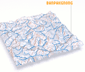 Places with similar names to Ban Pakgnong, Laos ::
// Ban Pakgnang (LA)
Disclaimer :: Information on this page comes without warranty of any kind |
||
|
Where is Ban Pakgnong? Elevation and coordinates ::
Latitude (lat): 21°2'2"N Longitude (lon): 102°49'34"E
Elevation (approx.): 437m (map arrows pan, magnifying glasses zoom) |
||
|
Visiting Ban Pakgnong? Hotel/Accommodation ::
Book a hotel in Ban Pakgnong Travel Guide ::
Buy a travel guide for Laos rental cars ::
car rental offers GPS waypoint ::
download a GPX waypoint (PoI) of Ban Pakgnong for your GPS receiver
|
||