|
search place name
|
||
Ban Phasong (Laos)Ban Phasong is a town in Laos. An overview map of the region around Ban Phasong is displayed below.
regional and 3d topo map of Ban Phasong, Laos ::

Ban Phasong airports ::
The nearest airport is ZVK - Savannakhet, located 103.7 km south west of Ban Phasong.
Other airports nearby include SNO - Sakon Nakhon (139.9 km west), Nearby towns ::
Ban Natat (2.6km north east) //
Ban Sangphai (3.7km south) //
Ban Phônkho (3.5km east) //
Ban Nalouang (4.1km north west) //
Ban Sokthang (4.0km north east) //
Ban Nakham (5.1km south west) //
Ban Nakatom (5.3km west) //
Ban Phalômbong (5.6km south) //
Ban Nampiat Thông (5.6km west) //
Ban Nampiat Dông (6.5km south west) //
Ban Dông Tai (6.6km north east) //
Ban Nanoy (6.6km north east) //
Ban Tèng (7.4km north) //
Ban Phahoy (7.6km south) //
Ban Nataphoy (7.6km north) //
Ban Nakhong (8.0km north east) //
[all distances 'as the bird flies' and approximate] 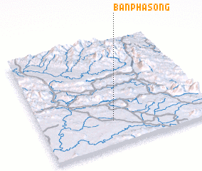 Places with similar names to Ban Phasong, Laos ::
// Ban Na Pho Song (TH)
// Ban Phai Sing (TH)
// Ban Phai Sing (TH)
// Ban Phai Sung (TH)
// Ban Pha Sing (TH)
// Ban Pha Sing (TH)
// Ban Pha Soung (LA)
// Ban Phasoung (LA)
// Ban Phou Sang (LA)
// Ban Phousang (LA)
Disclaimer :: Information on this page comes without warranty of any kind |
||
|
Where is Ban Phasong? Elevation and coordinates ::
Latitude (lat): 17°14'0"N Longitude (lon): 105°26'0"E
Elevation (approx.): 194m (map arrows pan, magnifying glasses zoom) |
||
|
Visiting Ban Phasong? Hotel/Accommodation ::
Book a hotel in Ban Phasong Travel Guide ::
Buy a travel guide for Laos rental cars ::
car rental offers GPS waypoint ::
download a GPX waypoint (PoI) of Ban Phasong for your GPS receiver
|
||