|
search place name
|
||
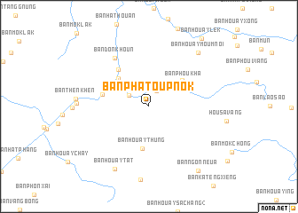
Ban Phatoup-Nok (Louangphrabang, Laos)Ban Phatoup-Nok is a town in the Louangphrabang region of Laos. An overview map of the region around Ban Phatoup-Nok is displayed below.
regional and 3d topo map of Ban Phatoup-Nok, Laos ::
Ban Phatoup-Nok airports ::
The nearest airport is LPQ - Luang Prabang Luang Phabang Intl, located 77.7 km south west of Ban Phatoup-Nok.
Nearby towns ::
Ban Houay-En-Noy (2.2km north east) //
Ban Houay-En (2.7km north west) //
Ban Lat-En (5.0km north west) //
Ban Phou Kha (5.1km north east) //
Ban Phatoup-Nai (5.1km north east) //
Ban Houaythung (5.4km south) //
Ban Houayhang (5.9km north west) //
Ban Phatèm (5.7km west) //
Ban Donkhoun (7.3km north west) //
Ban Houaytat (8.8km south west) //
Ban Houay Moum Noi (8.9km north east) //
Ban Ngon Neua (10.0km south east) //
Ban Houaylèk (10.6km north east) //
[all distances 'as the bird flies' and approximate] 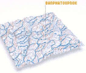 Places with similar names to Ban Phatoup-Nok, Laos :: Disclaimer :: Information on this page comes without warranty of any kind |
||
|
Where is Ban Phatoup-Nok? Elevation and coordinates ::
Latitude (lat): 20°27'22"N Longitude (lon): 102°36'39"E
Elevation (approx.): 501m (map arrows pan, magnifying glasses zoom) |
||
|
Visiting Ban Phatoup-Nok? Hotel/Accommodation ::
Book a hotel in Ban Phatoup-Nok Travel Guide ::
Buy a travel guide for Laos rental cars ::
car rental offers GPS waypoint ::
download a GPX waypoint (PoI) of Ban Phatoup-Nok for your GPS receiver
|
||