|
search place name
|
||
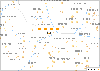
Ban Phônkang (Phôngsali, Laos)Ban Phônkang is a town in the Phôngsali region of Laos. An overview map of the region around Ban Phônkang is displayed below.
regional and 3d topo map of Ban Phônkang, Laos ::
Ban Phônkang airports ::
The nearest airport is LPQ - Luang Prabang Luang Phabang Intl, located 134.3 km south of Ban Phônkang.
Nearby towns ::
Khoa (1.7km north east) //
Koung So (3.5km south east) //
Ban Pong (3.5km south east) //
Lassa Moun (3.5km south east) //
Ban Tangkôk (3.5km north west) //
Ban Ômmôk (3.9km south west) //
Koung Leua Choi (4.2km south) //
Ban Sènlat (4.5km south west) //
Ban Phônsaat (4.7km south east) //
Ban Houaymouan (4.5km south west) //
Mok Lek (4.9km south west) //
Ban Phônsavan (5.2km south west) //
Ban Rua Yong (5.7km north west) //
Ban Ômtou (5.6km north east) //
Ban Chanmai-Kao (5.7km south west) //
Om Luck (6.1km south) //
Ban Sôpkai (6.1km south west) //
Ban Ômklô (6.5km south) //
Ban Chiti (6.3km south east) //
Ban Houayphè (6.8km north) //
Ban Chanmai (6.6km south west) //
Om Mok (1) (6.5km east) //
Ban Omlouk (6.5km west) //
Ban Ômmôk (7.1km south east) //
Ban Sangpong-Mai (7.1km south west) //
Ban Koungchom (7.4km south) //
Ban Houaylik (7.5km north) //
Om Mok (2) (7.4km south east) //
Koung Kouei (7.9km south) //
[all distances 'as the bird flies' and approximate] 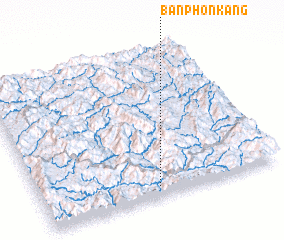 Places with similar names to Ban Phônkang, Laos ::
// Ban Phônkang (LA)
Disclaimer :: Information on this page comes without warranty of any kind |
||
|
Where is Ban Phônkang? Elevation and coordinates ::
Latitude (lat): 21°4'14"N Longitude (lon): 102°29'30"E
Elevation (approx.): 373m (map arrows pan, magnifying glasses zoom) |
||
|
Visiting Ban Phônkang? Hotel/Accommodation ::
Book a hotel in Ban Phônkang Travel Guide ::
Buy a travel guide for Laos rental cars ::
car rental offers GPS waypoint ::
download a GPX waypoint (PoI) of Ban Phônkang for your GPS receiver
|
||