|
search place name
|
||
Ban Phônthong (Louangphrabang, Laos)Ban Phônthong is a town in the Louangphrabang region of Laos. An overview map of the region around Ban Phônthong is displayed below.
regional and 3d topo map of Ban Phônthong, Laos ::

Ban Phônthong airports ::
The nearest airport is LPQ - Luang Prabang Luang Phabang Intl, located 114.8 km south of Ban Phônthong.
Nearby towns ::
Ban Makmong (1.7km north) //
Tiang Lang Lan (2.9km west) //
Ban Houayphiang (4.2km north) //
Ban Houayxang (4.5km west) //
Ban Phouviang (5.2km east) //
Ban Tanlôlôm (5.6km west) //
Ban Houaythong (6.4km north) //
Sen Pama (6.3km north east) //
Mok Piet (7.0km north) //
Ban Tom (7.0km south west) //
Ban Tamak (6.8km south west) //
Ban Houaysing (7.8km east) //
Ban Kiouthoung (8.1km south west) //
Mok Phek (8.1km east) //
Ban Pong Lai (8.4km west) //
Ban Kiou-Uang (8.4km west) //
Ban Latvan (8.9km north west) //
Ban Tamlouy (9.7km north east) //
Ban Hai (10.3km south east) //
[all distances 'as the bird flies' and approximate] 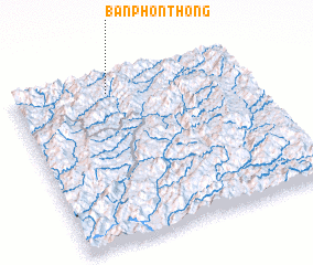 Places with similar names to Ban Phônthong, Laos ::
// Ban Phan Thong (TH)
// Ban Phon Thong (TH)
// Ban Phon Thong (TH)
// Ban Phon Thong (TH)
// Ban Phon Thong (TH)
// Ban Phon Thong (TH)
// Ban Phon Thong (TH)
// Ban Phon Thong (TH)
// Ban Phon Thong (TH)
// Ban Phon Thong (TH)
Disclaimer :: Information on this page comes without warranty of any kind |
||
|
Where is Ban Phônthong? Elevation and coordinates ::
Latitude (lat): 20°54'28"N Longitude (lon): 102°24'35"E
Elevation (approx.): 1039m (map arrows pan, magnifying glasses zoom) |
||
|
Visiting Ban Phônthong? Hotel/Accommodation ::
Book a hotel in Ban Phônthong Travel Guide ::
Buy a travel guide for Laos rental cars ::
car rental offers GPS waypoint ::
download a GPX waypoint (PoI) of Ban Phônthong for your GPS receiver
|
||