|
search place name
|
||
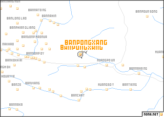
Ban Pongxang (Houaphan, Laos)Ban Pongxang is a town in the Houaphan region of Laos. An overview map of the region around Ban Pongxang is displayed below.
regional and 3d topo map of Ban Pongxang, Laos ::
Ban Pongxang airports ::
The nearest airport is HAN - Hanoi Noibai Intl, located 169.5 km north east of Ban Pongxang.
Nearby towns ::
Ban Chèfay (1.5km north) //
Ban Pongxang (1.5km north east) //
Ban Xan (1.8km south west) //
Ban Poun-Nua (2.0km south) //
Ban Kèngphoun (2.7km north west) //
Muang Poun (5.5km east) //
Ban Houayphông (7.1km south) //
Muang Chat (7.3km south) //
Ban Nayang (7.6km south) //
Ban O Lai (7.3km west) //
Ban Kangpabông (8.2km west) //
Ban Houayxai (8.4km north west) //
Muang Sôy (8.8km south east) //
Ban Bo (1) (9.3km north west) //
Ban Xang (9.7km south west) //
Ban Hèo (9.8km south west) //
Ban Na Ke (9.9km south west) //
Ban Bo-03 (10.2km north west) //
Ban Nahin (11.0km north west) //
[all distances 'as the bird flies' and approximate] 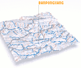 Places with similar names to Ban Pongxang, Laos ::
// Ban Pong Kasang (TH)
// Ban Pongxang (LA)
// Ban Poungxèng (LA)
// Ban Poungxoung (LA)
// Bản Púng Xăng (VN)
Disclaimer :: Information on this page comes without warranty of any kind |
||
|
Where is Ban Pongxang? Elevation and coordinates ::
Latitude (lat): 20°19'49"N Longitude (lon): 104°28'59"E
Elevation (approx.): 722m (map arrows pan, magnifying glasses zoom) |
||
|
Visiting Ban Pongxang? Hotel/Accommodation ::
Book a hotel in Ban Pongxang Travel Guide ::
Buy a travel guide for Laos rental cars ::
car rental offers GPS waypoint ::
download a GPX waypoint (PoI) of Ban Pongxang for your GPS receiver
|
||