|
search place name
|
||
Ban Samtôn (Louangphrabang, Laos)Ban Samtôn is a town in the Louangphrabang region of Laos. An overview map of the region around Ban Samtôn is displayed below.
regional and 3d topo map of Ban Samtôn, Laos ::

Ban Samtôn airports ::
The nearest airport is LPQ - Luang Prabang Luang Phabang Intl, located 102.0 km south west of Ban Samtôn.
Nearby towns ::
Ban Phônkham (1.2km west) //
Ban Ômchôi (2.2km north east) //
Ban Houaychan (2.9km north west) //
Ban Houaysangiao (3.8km north) //
Ban Phônngam (4.2km south west) //
Ban Houaycho-Gnai (4.4km south) //
Houay Long (4.4km north west) //
Ban Longxai (4.6km north) //
Ban Houaykou (5.3km south east) //
Sop Yang (5.2km west) //
Ban Phônviang (5.8km north) //
Ban Nanoy (5.8km north east) //
Ban Kadoun (6.5km south) //
Ban Hat-Houng (7.1km north west) //
Ban Nang Khouei (7.3km south west) //
Ban Houaycho-Noy (7.5km south) //
Ban Gnotxeuk (7.0km east) //
Ban Sè (7.6km west) //
Ban Vangheung (7.8km north west) //
Ban Paklao-Nua (8.0km north east) //
Ban Houaycho (8.1km south west) //
Ban Houaythong-Tai (8.4km south) //
Ban Hatgnao (8.2km north west) //
Ban Bom Vang (8.3km north west) //
Ban Hatlao (8.7km north) //
Ban Bouamban (8.6km north west) //
Ban Houayna (9.6km north east) //
Ban Donkhoun (9.6km north west) //
Ban Paklao-Noy (10.4km south east) //
[all distances 'as the bird flies' and approximate] 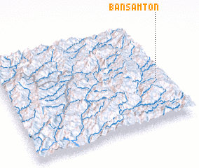 Places with similar names to Ban Samtôn, Laos ::
// Ban Samo Don (TH)
// Ban Samèt-Noy (LA)
Disclaimer :: Information on this page comes without warranty of any kind |
||
|
Where is Ban Samtôn? Elevation and coordinates ::
Latitude (lat): 20°26'29"N Longitude (lon): 102°56'57"E
Elevation (approx.): 846m (map arrows pan, magnifying glasses zoom) |
||
|
Visiting Ban Samtôn? Hotel/Accommodation ::
Book a hotel in Ban Samtôn Travel Guide ::
Buy a travel guide for Laos rental cars ::
car rental offers GPS waypoint ::
download a GPX waypoint (PoI) of Ban Samtôn for your GPS receiver
|
||