|
search place name
|
||
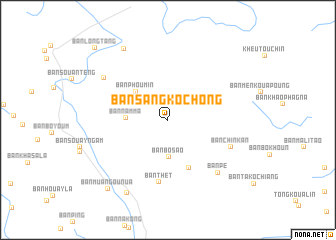
Ban Sangkochong (Phôngsali, Laos)Ban Sangkochong is a town in the Phôngsali region of Laos. An overview map of the region around Ban Sangkochong is displayed below.
regional and 3d topo map of Ban Sangkochong, Laos ::
Ban Sangkochong airports ::
The nearest airport is THL - Tachilek Tachileik, located 288.1 km south west of Ban Sangkochong.
Nearby towns ::
Ban Bosao (4.1km south) //
Ban Namma (4.3km west) //
Ban Phoumin (4.6km north west) //
Ban Mai-Nahôk (5.8km south) //
Ban Thét (7.0km south) //
Ban Chinkan (7.2km south east) //
Ban Pé (7.8km south east) //
Ban Euna (8.1km north west) //
Ban Khouangkosoung (9.1km north west) //
Ban Phokung (9.2km south west) //
Ban Muang-Ou-Nua (9.9km south west) //
Ban Longtang (11.0km north west) //
[all distances 'as the bird flies' and approximate]  Places with similar names to Ban Sangkochong, Laos :: Disclaimer :: Information on this page comes without warranty of any kind |
||
|
Where is Ban Sangkochong? Elevation and coordinates ::
Latitude (lat): 22°21'54"N Longitude (lon): 101°51'19"E
Elevation (approx.): 1132m (map arrows pan, magnifying glasses zoom) |
||
|
Visiting Ban Sangkochong? Hotel/Accommodation ::
Book a hotel in Ban Sangkochong Travel Guide ::
Buy a travel guide for Laos rental cars ::
car rental offers GPS waypoint ::
download a GPX waypoint (PoI) of Ban Sangkochong for your GPS receiver
|
||