|
search place name
|
||
Ban Saylia (Houaphan, Laos)Ban Saylia is a town in the Houaphan region of Laos. An overview map of the region around Ban Saylia is displayed below.
regional and 3d topo map of Ban Saylia, Laos ::

Ban Saylia airports ::
The nearest airport is HAN - Hanoi Noibai Intl, located 191.8 km north east of Ban Saylia.
Nearby towns ::
Sèn Khoun (0.7km east) //
Sèn Nam (1.1km west) //
Ban Phoulon (1.9km south) //
Ban Kèocha (1.9km west) //
Ban Cha Do (2.0km north west) //
Bao Saï (2.8km west) //
Ban Xiangxu (3.1km east) //
Viangxai (4.1km north east) //
Ban Nakay Teu (4.4km east) //
Ban Pahin (4.5km west) //
Ban Song Kouan (4.6km west) //
Ban Lao Chy (5.0km south west) //
Ban Namuang (5.1km east) //
Ban Muangnga (5.5km north) //
Ban Phoudôn (5.1km west) //
Ban Nathèn (5.5km north) //
Ban Nong Kou (5.4km north east) //
Ban Nakay Neua (5.4km north east) //
Ban Cha Khièn (5.8km north west) //
Ban Houaykhô (6.1km north west) //
Nam Khong (6.2km east) //
Ban Samthang (6.4km west) //
Ban Houeï Pahine (6.6km west) //
Ban Napha (7.1km east) //
Ban Houay Cha (7.3km south west) //
Ban Bo (7.6km north) //
Ban Houay Ta Bong (7.4km south west) //
Na Vit Teu (7.6km east) //
Ban Kaxeung (8.1km south) //
[all distances 'as the bird flies' and approximate] 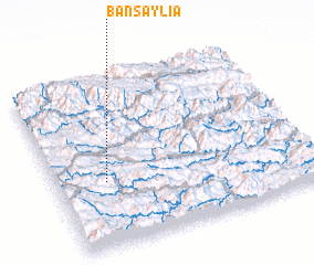 Places with similar names to Ban Saylia, Laos ::
// Bounezzal (MA)
// Bansal (PH)
// Banzal (PH)
// Benzal (US)
// Bonsall (US)
// Bonzel (DE)
// Bonsal (DE)
// Banzola (IT)
// Banī Şāliḩ (IQ)
// Banī Şāliḩ (IQ)
Disclaimer :: Information on this page comes without warranty of any kind |
||
|
Where is Ban Saylia? Elevation and coordinates ::
Latitude (lat): 20°23'5"N Longitude (lon): 104°11'38"E
Elevation (approx.): 866m (map arrows pan, magnifying glasses zoom) |
||
|
Visiting Ban Saylia? Hotel/Accommodation ::
Book a hotel in Ban Saylia Travel Guide ::
Buy a travel guide for Laos rental cars ::
car rental offers GPS waypoint ::
download a GPX waypoint (PoI) of Ban Saylia for your GPS receiver
|
||