|
search place name
|
||
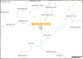
Ban Sôpyong (Houaphan, Laos)Ban Sôpyong is a town in the Houaphan region of Laos. An overview map of the region around Ban Sôpyong is displayed below.
regional and 3d topo map of Ban Sôpyong, Laos ::
Ban Sôpyong airports ::
The nearest airport is HAN - Hanoi Noibai Intl, located 229.9 km north east of Ban Sôpyong.
Other airports nearby include VTE - Vientiane Wattay Intl (264.0 km south west), Nearby towns ::
Ban Kèngko (3.7km north west) //
Bản Xang (4.6km south east) //
Ban Nakha (5.1km north) //
Ban Namuang (6.0km north east) //
Ban Phieng Tat (6.1km north east) //
Ban Namhan (6.9km north west) //
Ban Muangyông (8.4km north) //
Ban Sôpkang (8.2km west) //
Ban Houayphiang (8.5km north east) //
Xóm Tam (8.7km south west) //
Ban Phiangmon (9.2km north west) //
Ban Houayhè (9.3km north east) //
Ban Phiangdi (11.5km north west) //
[all distances 'as the bird flies' and approximate] 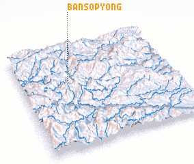 Places with similar names to Ban Sôpyong, Laos ::
// Ban Sap Yang (TH)
// Ban Sop Yang (TH)
Disclaimer :: Information on this page comes without warranty of any kind |
||
|
Where is Ban Sôpyong? Elevation and coordinates ::
Latitude (lat): 19°41'2"N Longitude (lon): 104°19'31"E
Elevation (approx.): 374m (map arrows pan, magnifying glasses zoom) |
||
|
Visiting Ban Sôpyong? Hotel/Accommodation ::
Book a hotel in Ban Sôpyong Travel Guide ::
Buy a travel guide for Laos rental cars ::
car rental offers GPS waypoint ::
download a GPX waypoint (PoI) of Ban Sôpyong for your GPS receiver
|
||