|
search place name
|
||
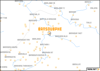
Ban Soub Phé (Laos)Ban Soub Phé is a town in Laos. An overview map of the region around Ban Soub Phé is displayed below.
regional and 3d topo map of Ban Soub Phé, Laos ::
Ban Soub Phé airports ::
The nearest airport is ZVK - Savannakhet, located 159.0 km south west of Ban Soub Phé.
Other airports nearby include PKZ - Pakse (222.8 km south), Nearby towns ::
Ban Vat (1.0km north west) //
Ban Tali (2.6km west) //
Ban Phou-Adouk (2.9km north west) //
Ban Tat-Itou (3.8km north) //
Ban Tiyé (4.3km north) //
Ban Vang-Ala (4.4km east) //
Ban Thami (4.9km south) //
Ban Namoun (4.8km north west) //
Ban Talikangkhô (5.1km north) //
Ban Lakô (5.3km south west) //
Ban Talék-Alam (5.4km north east) //
Ban Nachaling (6.1km south west) //
Ban Houaysout (6.6km south west) //
Ban Chalèt (6.5km south west) //
Ban Houang (7.2km south west) //
Ban Phakat (7.6km south) //
Ban Kapo (7.5km north west) //
Ban Kangtaloung (7.6km east) //
Ban Kadat (7.9km south west) //
Ban Namlin (8.0km south west) //
Ban Houayhong (8.2km south) //
Ban Alao (8.3km north east) //
Ban Patan (8.1km west) //
Ban Chala (8.7km north west) //
Thong Louang (8.9km south) //
Ban Houaypalay (9.2km south) //
Ban Boungsènkén (9.6km south west) //
Ban Phouhang (10.1km south west) //
Ban Hon (11.3km north east) //
[all distances 'as the bird flies' and approximate] 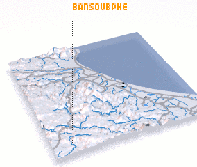 Places with similar names to Ban Soub Phé, Laos :: Disclaimer :: Information on this page comes without warranty of any kind |
||
|
Where is Ban Soub Phé? Elevation and coordinates ::
Latitude (lat): 17°7'0"N Longitude (lon): 106°8'0"E
Elevation (approx.): 429m (map arrows pan, magnifying glasses zoom) |
||
|
Visiting Ban Soub Phé? Hotel/Accommodation ::
Book a hotel in Ban Soub Phé Travel Guide ::
Buy a travel guide for Laos rental cars ::
car rental offers GPS waypoint ::
download a GPX waypoint (PoI) of Ban Soub Phé for your GPS receiver
|
||