|
search place name
|
||
Ban Vanggnêng (Khammouan, Laos)Ban Vanggnêng is a town in the Khammouan region of Laos. An overview map of the region around Ban Vanggnêng is displayed below.
regional and 3d topo map of Ban Vanggnêng, Laos ::

Ban Vanggnêng airports ::
The nearest airport is SNO - Sakon Nakhon, located 142.2 km south west of Ban Vanggnêng.
Other airports nearby include ZVK - Savannakhet (193.0 km south), Nearby towns ::
Ban Phônsoung (1.4km east) //
Ban Chalèt (2.2km north west) //
Ban Kaan (3.3km east) //
Ban Phônsa-At (5.1km east) //
Ban Boung (5.2km west) //
Ban Fan (6.9km east) //
Ban Sôpkhôm (7.1km east) //
Ban Sôppon (7.9km west) //
Ban Pahôk (9.3km north west) //
Muang Khamkeut (11.2km south west) //
[all distances 'as the bird flies' and approximate] 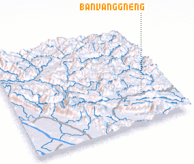 Places with similar names to Ban Vanggnêng, Laos ::
// Ban Phiang-Nang (LA)
// Ban Phôn-Gnèng (LA)
// Ban Vang Gnèng (LA)
// Ban Vanggnong (LA)
// Ban Vang-Nang (LA)
// Ban Vang-Niang (LA)
// Ban Vangnong (LA)
Disclaimer :: Information on this page comes without warranty of any kind |
||
|
Where is Ban Vanggnêng? Elevation and coordinates ::
Latitude (lat): 18°17'59"N Longitude (lon): 104°48'12"E
Elevation (approx.): 437m (map arrows pan, magnifying glasses zoom) |
||
|
Visiting Ban Vanggnêng? Hotel/Accommodation ::
Book a hotel in Ban Vanggnêng Travel Guide ::
Buy a travel guide for Laos rental cars ::
car rental offers GPS waypoint ::
download a GPX waypoint (PoI) of Ban Vanggnêng for your GPS receiver
|
||