|
search place name
|
||
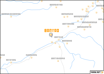
Ban Yao (Laos)Ban Yao is a town in Laos. An overview map of the region around Ban Yao is displayed below.
regional and 3d topo map of Ban Yao, Laos ::
Ban Yao airports ::
The nearest airport is THL - Tachilek Tachileik, located 128.3 km south west of Ban Yao.
Other airports nearby include KET - Kengtung (144.0 km west), LPQ - Luang Prabang Luang Phabang Intl (177.2 km south east), MOG - Mong Hsat (191.4 km west), Nearby towns ::
Pang Kalom (1.9km south) //
Ban Mouang (2.5km south east) //
Ban Tèxa (2.4km south east) //
Ban Tinthat (4.3km south east) //
Ban Namma (5.5km south east) //
Ban Tami-Kao (6.7km north east) //
Ban Namhou (8.4km north east) //
Ban Tiakampià (8.9km south) //
Ban Sang Mie (9.0km north east) //
Muong Kang (10.1km south west) //
[all distances 'as the bird flies' and approximate]  Places with similar names to Ban Yao, Laos ::
// Banoyo (PH)
// Banuyao (PH)
// Banuyao (PH)
// Banuyo (PH)
// Banuyo (PH)
// Banuyo (PH)
// Bunuaya (PH)
// Banīyah (IQ)
// Ban Ai Yai (TH)
// Ban Ai Yai (TH)
Disclaimer :: Information on this page comes without warranty of any kind |
||
|
Where is Ban Yao? Elevation and coordinates ::
Latitude (lat): 21°4'0"N Longitude (lon): 101°0'0"E
Elevation (approx.): 825m (map arrows pan, magnifying glasses zoom) |
||
|
Visiting Ban Yao? Hotel/Accommodation ::
Book a hotel in Ban Yao Travel Guide ::
Buy a travel guide for Laos rental cars ::
car rental offers GPS waypoint ::
download a GPX waypoint (PoI) of Ban Yao for your GPS receiver
|
||