|
search place name
|
||
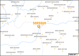
Sopsoum (Laos)Sopsoum is a town in Laos. An overview map of the region around Sopsoum is displayed below.
regional and 3d topo map of Sopsoum, Laos ::
Sopsoum airports ::
The nearest airport is THL - Tachilek Tachileik, located 265.2 km south west of Sopsoum.
Nearby towns ::
Ban Tha (0.2km south east) //
Ban Tang (0.5km north west) //
Ban Tang (1) (1.9km north east) //
Ban Houay-Ou (3.3km south) //
Ban Sôpxou (3.7km south) //
Ban Akhapoupong (5.0km south) //
Ban Tasan (2) (5.0km north west) //
Ban Oupao (4.9km north east) //
Ban Sinchai (5.3km south east) //
Ban Tasan (1) (6.9km north west) //
Ban Phounyéfan (7.0km south west) //
Ban Ou (7.2km north east) //
Ban Laomachai (8.3km south east) //
Ban Tong (8.5km north) //
Ban Konsito (8.6km south) //
Ban Hoydoy (8.4km north west) //
Ban Lôphagna (10.0km south east) //
Ban Oupao-Nua (10.4km north east) //
Ban Tapeusou-Nua (10.9km north east) //
[all distances 'as the bird flies' and approximate] 
Disclaimer :: Information on this page comes without warranty of any kind |
||
|
Where is Sopsoum? Elevation and coordinates ::
Latitude (lat): 22°2'0"N Longitude (lon): 101°53'0"E
Elevation (approx.): 644m (map arrows pan, magnifying glasses zoom) |
||
|
Visiting Sopsoum? Hotel/Accommodation ::
Book a hotel in Sopsoum Travel Guide ::
Buy a travel guide for Laos rental cars ::
car rental offers GPS waypoint ::
download a GPX waypoint (PoI) of Sopsoum for your GPS receiver
|
||