|
search place name
|
||
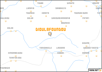
Dioulafoundou (Mali)Dioulafoundou is a town in Mali. An overview map of the region around Dioulafoundou is displayed below.
regional and 3d topo map of Dioulafoundou, Mali ::
Dioulafoundou airports ::
The nearest airport is KYS - Kayes Dag Dag, located 109.9 km north west of Dioulafoundou.
Other airports nearby include SEY - Selibabi Selibady (224.8 km north west), BXE - Bakel (230.3 km north west), KGG - Kedougou (239.2 km south west), Nearby towns ::
Tankombélé (5.8km south) //
Lassana (6.6km south east) //
Diakoumbaramania (6.6km north east) //
Bouréko (6.5km north east) //
Komata (7.6km north) //
Kabori (8.2km south east) //
Golua (9.1km north west) //
Fatola (10.3km north west) //
Tourako (10.3km north west) //
[all distances 'as the bird flies' and approximate]  Places with similar names to Dioulafoundou, Mali ::
// Delvinta (US)
// Tolvandī (IR)
// Dilafoundou (GN)
// Tall Afandī (SY)
// Dialafoundou (ML)
// Dioulafandou (ML)
// Dioulafondo (ML)
// Dioulafondo (ML)
// Dioulafondou (ML)
// Dioulafoundou (ML)
Disclaimer :: Information on this page comes without warranty of any kind |
||
|
Where is Dioulafoundou? Elevation and coordinates ::
Latitude (lat): 13°58'0"N Longitude (lon): 10°32'0"W
Elevation (approx.): 300m (map arrows pan, magnifying glasses zoom) |
||
|
Visiting Dioulafoundou? Hotel/Accommodation ::
Book a hotel in Dioulafoundou Travel Guide ::
Buy a travel guide for Mali rental cars ::
car rental offers GPS waypoint ::
download a GPX waypoint (PoI) of Dioulafoundou for your GPS receiver
|
||