|
search place name
|
||
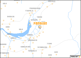
Farakan (Koulikoro, Mali)Farakan is a town in the Koulikoro region of Mali. An overview map of the region around Farakan is displayed below.
regional and 3d topo map of Farakan, Mali ::
Farakan airports ::
The nearest airport is BKO - Bamako Senou, located 30.6 km south west of Farakan.
Nearby towns ::
Palasso (1.0km north) //
Farakan Ouéré (1.8km south east) //
Kokoun (1.9km south) //
Mofa (2.6km north east) //
Massakoni (3.0km south) //
Sébéla (3.9km south west) //
Sènkoro (4.1km north west) //
Tanima (4.5km north) //
Tyèma (5.2km south west) //
Markaforo (5.3km west) //
Kénya (5.9km north west) //
Nionian (6.1km south west) //
Soundougouba (6.7km south west) //
Sadio Ouéré (7.2km south west) //
Djinkom (7.9km north west) //
Noumoubougou (8.4km north west) //
Fougadougou (8.7km north) //
Tyènfala (8.8km north west) //
Konyimba (8.8km south west) //
Tyéma (8.9km south east) //
Sala (8.7km west) //
Kasséla (9.4km south east) //
Baguinéda (9.9km south west) //
[all distances 'as the bird flies' and approximate]  Places with similar names to Farakan, Mali ::
Disclaimer :: Information on this page comes without warranty of any kind |
||
|
Where is Farakan? Elevation and coordinates ::
Latitude (lat): 12°40'15"N Longitude (lon): 7°42'18"W
Elevation (approx.): 314m (map arrows pan, magnifying glasses zoom) |
||
|
Visiting Farakan? Hotel/Accommodation ::
Book a hotel in Farakan Travel Guide ::
Buy a travel guide for Mali rental cars ::
car rental offers GPS waypoint ::
download a GPX waypoint (PoI) of Farakan for your GPS receiver
|
||